January
Fostering Citizen Scientists in the Remote Reaches of Colorado
Elizabeth ‘Liz’ Johnson, Colorado Northwestern Community College, Craig, CO
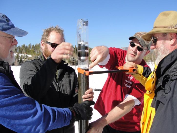
Abstract: Elizabeth ‘Liz’ Johnson’s presentation will focus on the critical need for outreach in remote areas of northwest Colorado, not only to successfully find and extract significant paleontological specimens, but also to ignite, teach, and foster an excitement about the advances and relevancy of the scientific process to everyone. Johnson’s background is in molecular paleontology – the preservation of original organic molecules in fossil bone. Utilizing her extensive interdisciplinary skill set, she currently teaches a broad spectrum of sciences at Colorado Northwestern Community College (CNCC) in Craig, CO. In 2014, she instituted a new and unique partnership between a BLM Government fossil repository and the paleontology education program at the Community College level. This collaboration is designed both to prospect, collect, and prepare specimens, and simultaneously to educate students and the public within CNCC’s service area. The marvelous and scientifically important specimens currently being excavated and prepared are under study by researchers from a variety of universities and institutions. This research helps to inspire individuals of all education and age levels. Johnson has witnessed the importance of working with local communities to give citizens ownership in the scientific process. Her work and leadership have demonstrated that building strong relationships between paleontologists, ranchers, and federal officials in northwest Colorado benefits all parties.
=
Science With a Social Conscience: A Natural Outgrowth of Fieldwork in Remote Regions of the World
David Krause, Denver Museum of Nature and Science
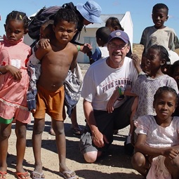
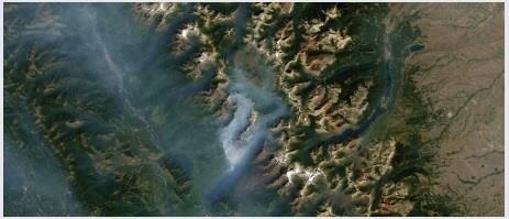
Abstract: Dave Krause’s presentation will focus on field science conducted in Madagascar, one of the very poorest countries on Earth. The paleontological project that he initiated there 25 years ago focused on the collection and analysis of Late Cretaceous vertebrates, everything from fishes to dinosaurs to mammals, and their geological context. The project has yielded exquisitely preserved and complete skulls and skeletons that have allowed him and his teams to address hypotheses concerning the plate tectonic and biogeographic history of not just Madagascar but of the entire southern supercontinent of Gondwana. This research also led to interactions with various indigenous populations in remote regions of the island and the realization that field scientists, who benefit greatly from working in such areas, have the opportunity to give back and thereby make a meaningful difference in the lives of those much less fortunate. Dave will review some of his work with children, work that has had the ability to profoundly change, and even save, lives. He will conclude by attempting to extrapolate to other field sciences and other areas, emphasizing that there is much need, and therefore much opportunity to make a difference, whether it be on remote islands like Madagascar or in under-served areas in this country. Field scientists working in remote areas are, in some ways, uniquely positioned to be “first responders for science.”
Biography: Dr. David Krause is Senior Curator of Vertebrate Paleontology at the Denver Museum of Nature and Science (Denver, CO; since 2016); Emeritus Distinguished Service Professor in the Department of Anatomical Sciences, Department of Geosciences, and Interdepartmental Doctoral Program in Anthropological Sciences at Stony Brook University (Stony Brook, NY); Research Associate of the Field Museum of Natural History (Chicago, IL); Founder and Executive Director of the Madagascar Ankizy Fund (www.ankizy.org); former Editor of the Journal of Vertebrate Paleontology (1987–1990); and former Vice President (1992–1994) and President (1994–1996) of the Society of Vertebrate Paleontology. Born and raised on a cattle ranch in southeastern Alberta, Dr. Krause received his B.Sc. and M.Sc. from the University of Alberta (Zoology) and his Ph.D. from the University of Michigan (Geology, 1982). He was also awarded a Distinguished Alumni Award from the University of Alberta in 2010 and an honorary doctorate from The University of Antananarivo (Madagascar) in 2012.
February
In the Footsteps of Darwin
Rob Wesson, USGS Scientist Emeritus
Abstract: Everybody knows―or thinks they know―Charles Darwin, the father of evolution and the man who altered the way we view our place in the world. But what most people do not know is that Darwin was on board the HMS Beagle as a geologist―on a mission to examine the land, not flora and fauna. Or about Darwin’s seminal role in demonstrating and exploring the ups and down of the Earth’s crust. This is the story told in Rob Wesson’s book, Darwin’s First Theory, and that he will share with us.
Retracing Darwin’s footsteps in South America and beyond, Rob trekked across the Andes, cruised waters charted by the Beagle, hunted for fossils in Uruguay and Argentina, and explored sites of long vanished glaciers in Scotland and Wales. As he followed Darwin’s path―literally and intellectually―he experienced the land as Darwin did, engaged with his observations, and tackled the same questions Darwin had about our ever-changing Earth.
Upon his return from his five-year journey aboard the Beagle, after examining the effects of earthquakes, tsunamis, volcanic eruptions, and more, Darwin conceived his theory of subsidence and uplift‚―his first theory. These concepts and attitudes―the vastness of time; the enormous cumulative impact of almost imperceptibly slow change; change as a constant feature of the environment―underlie Darwin’s subsequent discoveries in evolution. And this peculiar way of thinking remains vitally important today as we enter the human-dominated Anthropocene age.
As the New York Time Book Review wrote, Rob’s book “dares, thank goodness, to work some of the rare Darwinian territory that is actually underexplored. Tracing the young Darwin’s tracks …Wesson relates how Darwin hatched his first, favorite, and most overlooked substantive theory, on the origins of coral reefs. In both method and vision—imagining forms changing slowly over time in response to changing conditions—this precocious, even audacious idea anticipated and possibly inspired the theory of evolution Darwin would publish two decades later.”
Short Biography: Rob Wesson is an earth scientist who also loves stories. As a kid growing up in the Pacific Northwest, he became fascinated by mountains and glaciers. This interest led to a BS in earth science from MIT, and an MS and PhD in geophysics from Stanford University. His career in earthquake research with the U.S. Geological Survey (USGS) spans four decades, where he is currently a Scientist Emeritus. He has also written about science for a popular audience for the USGS and for Scientific American. In retirement, his research has turned to Chile where he is collaborating with a team exploring large earthquakes, tsunamis, and associated tectonic questions. This work has been supported in part by grants from the National Science Foundation. When not traveling to South America or elsewhere, Rob divides his time between his home in Evergreen, Colorado, and the cabin he built near McCarthy, Alaska.
Rob first became interested in Darwin and his geology through reading The Voyage of the Beagle on a vacation trip to Patagonia. He became captivated by Darwin’s prodigious powers of observation and his insatiable need to understand and explain. Whatever rock, fossil, landscape, rodent, bird, or beetle that he found, Darwin wanted to tell its story.
How the 1859 Gold Rush put Colorado on the Map
Wesley Brown, Rocky Mountain Map Society
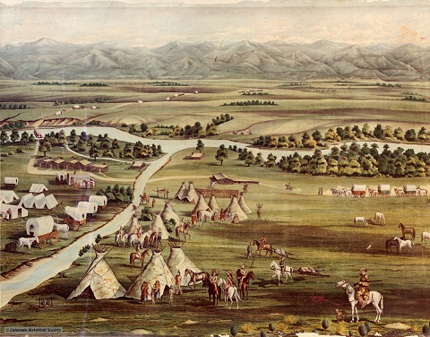
Abstract: In the spring of 1858, Colorado’s Front Range area was uncharted and inhabited only by Native Americans. But by the close of 1859, 100,000 fortune seekers had thoroughly explored the Front Range, north of Pueblo to the Wyoming border. In their quest for gold, they left their footprints on the landscape, establishing dozens of settlements and blazing numerous trails. This slide show and lecture will teach you about Colorado’s gold rush and how this important chapter of history influenced Colorado maps of today.
Short Biography: Wesley Brown has been a collector, student, and author of old maps for 40 years. He confines his map collecting to two areas (1) the earliest world maps up to the year 1540 and (2) the exploration and settlement of Colorado from the 16th through 20th centuries. A Denver resident, he co-founded the Rocky Mountain Map Society in 1990 and served as its President for its first seven years. He has served as the Co-Chairman of the Philip Lee Phillips Society (the national map and geography society of the Library of Congress). Wes has long been associated with the Denver Public Library, as one of its mayoral-appointed Commissioners where he served as President and where he is still active in acquisitions for the institutions important western map collection. He has published many papers on maps.
Wes first started using maps at age 16 as a mountain climber and has climbed about 400 different named peaks in Colorado. He is currently a Field Active Member of the Alpine Rescue Team.
March
Challenges in Providing Real-time Earthquake Shaking and Impacts Estimates
David Wald, U.S. Geological Survey, National Earthquake Information Center, and Adjunct Associate Professor of Geophysics, Colorado School of Mines, Golden, Colorado
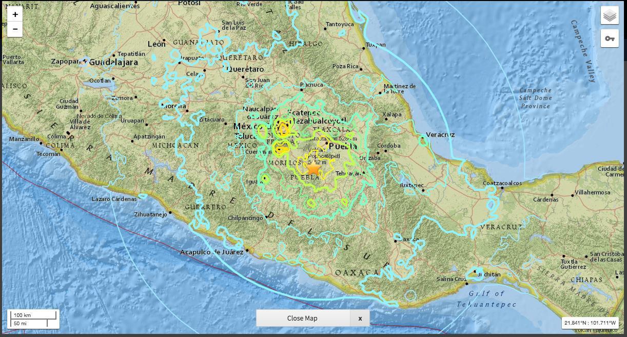
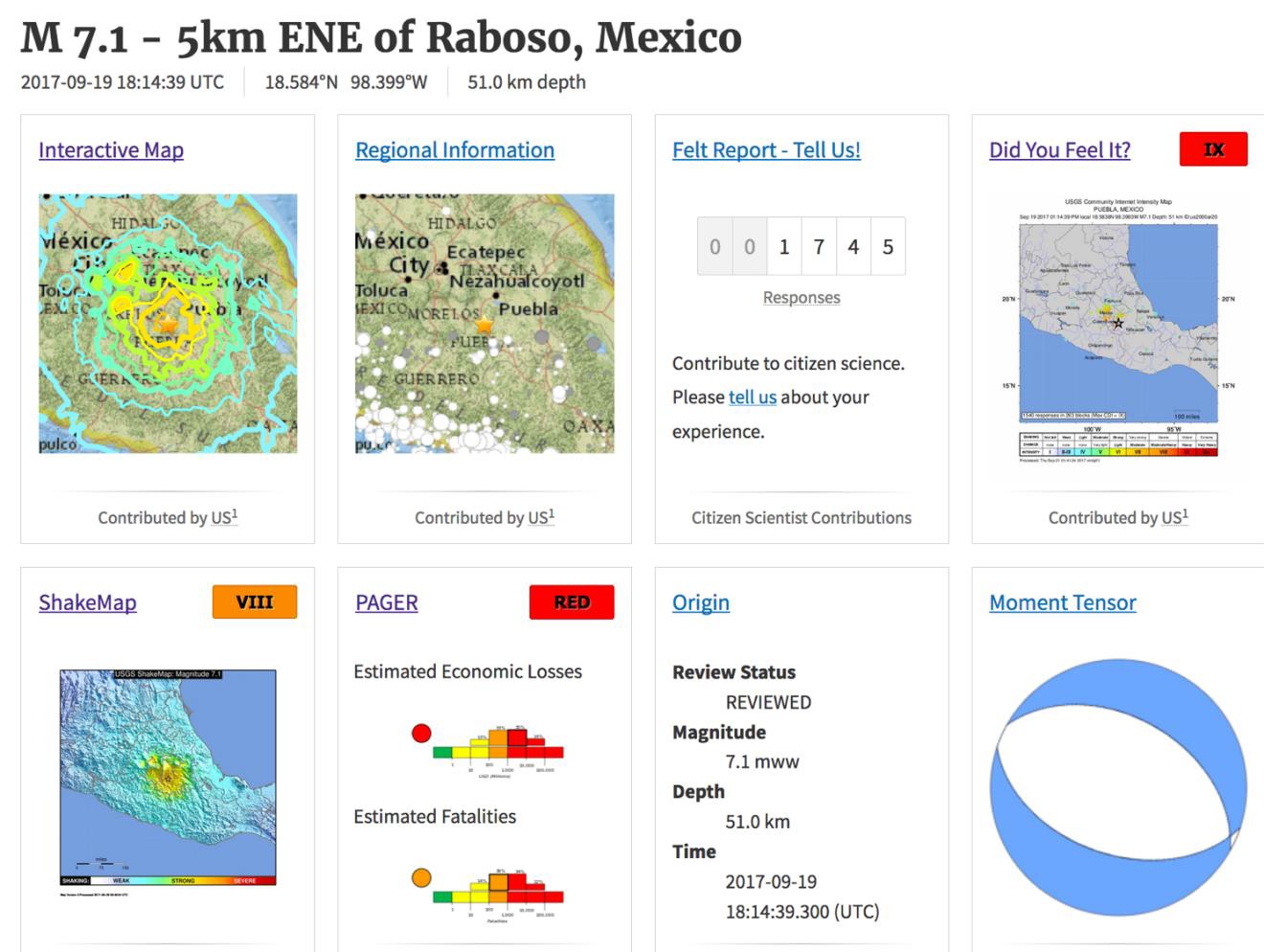
Abstract: USGS has recently developed several near-real time earthquake information systems that provide rapid and automated alerting of shaking distribution, critical facility inspection priorities, and estimates of economic and human impacts following earthquakes. I’ll describe the science and development behind the components required to rapidly assess an earthquake’s impact: rapid faulting characterization, estimates of shaking distribution, losses estimates, and communicating uncertain loss estimates in an appropriate form for actionable decision-making among a variety of critical users.
Rapidly and automatically assessing shaking and impact requires aggregating and interpreting a wide range of seismological, demographic, structures, economic and vulnerability information necessary to make such loss estimates strategies. In the course of explaining the end-to-end strategies and science/engineering employed by the USGS Prompt Assessment for Global Earthquake for Response (PAGER) system, we describe other challenges in making such information public rapidly. We’ll also cover recent seismological advances like earthquake early warning, and rapid estimates of earthquake-induced landsliding around the globe. Lastly, we’ll show how (re)insurers, governments and aid organizations use rapid earthquake information for loss estimation, situational awareness, and financial adjudication. Such financial tools can be a significant benefit to the at-risk public by facilitating risk transfer, fostering sensible management of portfolios, and assisting disaster response.
Biography: Dr Wald is a Seismologist with the USGS in Golden, Colorado, and is on the Geophysics Faculty at the School of Mines (CSM). Wald is involved in research, development and operations of real-time information systems at the USGS National Earthquake Information Center. He developed and manages “ShakeMap”, “Did You Feel it?”, and is responsible for developing other systems for post-earthquake response and pre-earthquake mitigation, including ShakeCast and PAGER.
Wald earned his B.S. in Physics and Geology at St. Lawrence University, an M.S. in Geophysics at the University of Arizona, and his Ph.D. in Geophysics at Caltech. Previously at Caltech, and now at the CSM, Wald has advised dozens of post-doctoral, graduate, and undergraduate students’ research projects. His own scientific interests include the characterization of rupture processes from complex earthquakes; analysis of ground motions and site effects; and modeling earthquake-induced landslides, liquefaction, and shaking-based losses. Wald has been the Seismological Society of America (SSA) Distinguished Lecturer a BSSA’s Associate Editor, and served on the Society’s Board of Directors. He served on the Earthquake Engineering Research Institute’s (EERI) Board of Directors, as Associate Editor for Earthquake Spectra, and was EERI’s 2014 Distinguished Lecturer. He was awarded SSA’s 2009 Frank Press Public Service Award, the Department of the Interior Superior Service Award in 2010, and their Meritorious Service Award in 2016.
April
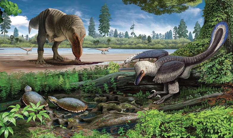
Colorado’s Amazing Dinosaurs: A History of Discoveries from the Centennial State
2018 Colorado Scientific Society Past Presidents Dinner
Joe Sertich, Denver Museum of Nature and Science
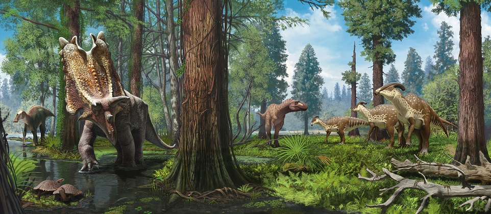
Abstract: The rich geology of Colorado captures nearly the entire evolutionary history of dinosaurs, ranging from their first appearance in the Triassic 240 million years ago to the last dinosaurs of the Cretaceous 66 million years ago. Included are the Rocky Mountain West’s iconic Jurassic dinosaurs like Stegosaurus and Allosaurus, so abundant in Colorado quarries they became a target of the late 1800’s “Bone Wars.” Cretaceous fossils preserved across Colorado capture the height of dinosaur evolution on “Laramidia” in addition to subtropical landscapes inhabited by the last dinosaurs to walk North America, the iconic Tyrannosaurus rex and Triceratops. New discoveries from the Front Range, like the spectacular ‘Thornton Torosaurus,’ promise to solve recent dinosaur mysteries and have ignited a dinosaur renaissance in Denver, the only major metropolitan area where dinosaurs still lurk in backyards.
Biography: Joe Sertich is Curator of Dinosaurs at the Denver Museum of Nature & Science. He received his B.S. in from Colorado State University in 2004, his M.S. at the University of Utah in 2006, and his Ph.D. from Stony Brook University in 2011. His research focuses on dinosaurs, crocodiles, and flying reptiles, and their ecosystems, during the Late Cretaceous. His field-based research is split between the Gondwanan continents of the southern hemisphere and western North America. He is one of the primary researchers on the Madagascar Paleontology Project exploring the latest Cretaceous of Madagascar and has expanded the search for dinosaurs to older deposits across the island. He is also working on several projects searching for the first latest Cretaceous dinosaurs of Africa, including work in northern Kenya and Egypt. In North America, he leads the Laramidia Project, currently leading work to uncover a lost world of dinosaurs in the Cretaceous of Grand Staircase-Escalante National Monument, Utah, northwestern New Mexico, and northwestern Colorado.
CSS April Meeting
The Role of the USGS (US Geological Survey) and CGS (Colorado Geological Survey)
Eugene (Buddy) Schweig, Director, USGS Geosciences and Environmental Change Science Center
Karen Berry, Director and State Geologist, Colorado Geological Survey
The present and future of the Colorado Geological Survey
Karen Berry, Director and State Geologist, Colorado Geological Survey
What has the Colorado Geological Survey been up to since it moved to Mines five years ago? Karen Berry will discuss some of the current and future projects CGS is working on and opportunities for collaboration.
Geological studies at the USGS in Denver: Where are we now and where are we headed?
Eugene (Buddy) Schweig, Director, Center for Geosciences and Environmental Change, U.S. Geological Survey, Lakewood, CO
The U.S. Geological Survey is undergoing some profound changes and these are affecting the research that the geology groups are doing at the Denver Federal Center. In spite of this and extreme budget uncertainty, we are looking at exciting new directions in geological mapping and mineral resources that will have implications for our work in Colorado and adjacent states for years to come. I will talk about the range of our projects in Colorado, what is coming to an end, and our plans for the next few years.
May, Emmons Lecture
From Snowball Earth to the Paleocene-Eocene Thermal Maximum: Lessons Learned from Earth System Extremes
Will Clyde, University of New Hampshire
“About 55 million years ago, the Earth burped up a massive release of carbon dioxide into the atmosphere – an amount equivalent to burning all the petroleum and other fossil fuels that exist today. “And we don’t know where it came from.”
Abstract: We study human history to provide context for understanding the present and making projections into the future. Understanding the Earth system is no different. Reconstructing the geological past offers a window into the functioning of the Earth system over long timescales – timescales over which direct observations are impossible. In particular, by identifying and studying extreme conditions of the Earth system in deep time, we are better able to constrain Earth’s boundary conditions. In this presentation, I will review the key geological evidence for several extreme events in Earth history and highlight the lessons they offer for today and the future. In particular, I will focus on the causes and effects of the Paleocene-Eocene Thermal Maximum and other early Paleogene hyperthermals. These events provide an intimate window into the feedbacks and teleconnections of the Earth system during periods of rapid global warming that thus have important implications for today.
Biography: Will Clyde is the Carpenter Professor of Geology in the Department of Earth Sciences at University of New Hampshire. He is fundamentally interested in Earth history and especially in how climate change, tectonics, and other geological forces have influenced mammalian evolution and shaped the terrestrial sedimentary record. He oversees the UNH Paleomagnetism Lab where he and his students use magnetostratigraphy to help determine the age of terrestrial fossil assemblages so they can be compared across continents and to coeval marine assemblages.
September
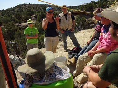
Poster Session by CSS Members and Short Talks by Students
CSS Meeting Announcement, Sept-20-2018 (PDF)
For abstracts of the poster presentations and talks see:
CSS Mtg. Sept-20-2018 Abstracts of Posters and Oral Presentations (PDF)
Oral presentations:
The effects of geological structure and clay on landslides in the Teklanika Formation in Denali National Park and Preserve, Alaska,
Michael Frothingham, PhD student, CU Boulder
Abstract: The dramatic landscape of Denali National Park and Preserve is sculpted by extreme geological forces of uplift and erosion along a major plate boundary. Visitors to the park have the unique opportunity to witness these forces as they occur while scientists, engineers, and staff are tasked with understanding and mitigating the geological hazards associated with them. In response to the many landslides present along the park road corridor, this project identifies, characterizes, and maps the clay and geological structures that are associated with landslides between miles 31 to 53 along the park road.
Clay occurs within the Paleocene Teklanika Formation as an alteration product in moderately continuous stratigraphic horizons of tuff, perlite, and rhyolite that are traceable across structural geometries. Landslides also contain this clay, which is mixed in with debris. Major landslides often occur where the following conditions unique to the Teklanika Formation are met: (1) erosion occurs along a weak horizon of clay, (2) topography above clay horizon is steepened, (3) large colluvium piles are accumulated near the clay horizon, and (4) detrital clay is mixed in with colluvium. Following these conditions, landslides are triggered when the critical shear stress of clay-rich debris is achieved by hydration and weakening of clays, degradation of permafrost or seasonal frost, overloading, or debuttressing.
Newly-identified geological controls suggest increased landslide probability where the basal tuff and clay horizon marks the contact of Teklanika and Cantwell formations, and where steeply-dipping perlite and clay horizons intersect faults or sharp topographic relief. Using the geologic map of clay occurrence, stratigraphy, and structure with reference to landslide conditions listed above, this project illuminates the cause of past and present landslides, and can be used to predict and mitigate future geological hazards.
Insight into incipient motion of blocks on a river bed from Computation Fluid Dynamics modeling,
Aaron Hurst, PhD student, CU Boulder
Abstract: Erosion of bedrock river channels is an important driver of landscape evolution, as it governs the baselevel lowering rate of adjacent hillslopes in mountainous landscapes. In many settings, the upstream migration of bedrock steps or small knickpoints accomplishes most of the vertical erosion in bedrock channels. However, as most models of channel evolution focus on abrasion without accounting for the entrainment of blocks at the downstream edges of bed steps, the magnitude of channel erosion and the detailed geometry of bedrock channels are not well captured. In order to quantitatively capture the role of channel erosion by block entrainment, or plucking, in future models, we first require insight into the physics of incipient motion of blocks on a bedrock channel bed. To date, all of the theory and experiments that inform plucking models are based upon force balances on individual blocks (i.e., Dubinski and Wohl, 2013; Lamb, 2015) with limited application to larger scale models of landscape evolution (i.e., Shobe et al., 2017; Larsen et al., 2016). A significant hurdle in predicting block entrainment by plucking is the lack of sufficient data to defend the choice of a drag coefficient that informs block entrainment thresholds in these force balances. We currently lack consistent predictions of the proper drag coefficient necessary to estimate the drag force, and lack constraints on the magnitudes of pressures to which the vertical edges of a block are subjected in a given flow. We hypothesize that short temporal scale fluctuations in the water pressure in the recirculation zone downstream of a block in open channel turbulent flow greatly influences the magnitude of the drag force acting on the block, and thus values of drag coefficients and pressure differences that should be used in calculation of the force balances. These recirculation zone lengths reflect a combination of block and upstream step geometries and turbulent fluctuations in the flow. We use Computation Fluid Dynamics (CFD) experiments to test the effects of block and step geometries on drag coefficients in order to estimate the range of drag coefficients to be expected for given block aspect ratios and protrusion heights that are found in natural streams. We then use these constraints to develop a relationship between drag, channel geometry, and block geometry that will place future channel evolution models on firm physics-based ground.
Seasonality of a Sub-Alpine Lake: Understanding evolving physical and biogeochemical controls on aquatic ecosystem structure under ice cover. Rocky Mountain National Park, Colorado USA,
Garrett Rue, PhD Candidate, CU Boulder
Abstract: In mountainous regions such as Colorado’s Front Range, changes in hydroclimatology and enhanced exogenous input of nitrogen from atmospheric deposition, are driving changes in lake ecosystems. While summer is an important period when primary production dominates lake ecosystem structure and function, less is known about how these trophodynamics change during the longer period of winter ice-cover. Ongoing research of Bear Lake, located in the sub-alpine of Rocky Mountain National Park, Colorado, USA has shown that depth profiles of dissolved oxygen change in the lake due to variation of snow cover on the ice. Preferential deposition of snow on the east side of the lake driven by wind creates a shallower depth to the oxycline by limiting light penetration through the snow and ice to support photoautotrophs compared to the snow-free west side of the lake. However, concentrations of dissolved organic carbon (DOC) appear consistent across these surface cover conditions and predictably increase by depth. Under the competing role of snow cover influencing primary production near the surface in producing oxygen against heterotrophic processes consuming it at increasing depths, we hypothesize that the developing strata create a redox gradient where dissolved organic matter (DOM) accumulates in a reduced state below the oxycline to essentially act as a battery to store chemical energy. Favoring heterotrophic activity, this further promotes the assimilation of nitrogen into the DOM pool and an evolving reservoir of labile carbon primed to jumpstart the aquatic ecosystem during lake turnover in the spring. We present data collected from Bear Lake throughout the winter of 2018, to better elucidate these shifts in aquatic ecosystem function against physical and chemical conditions. This both advances our understanding of oligotrophic, mountain lake sensitivity to change and predicting response to future pressure, also identifying key biogeochemical processes that may seasonally control microbial and planktonic foodweb structure.
The role of flashing in the formation of high-grade, low-sulfidation epithermal deposits: a case study from the Omu Camp in Hokkaido, Japan,
Lauren Zeeck, MS Candidate, Colorado School of Mines
Abstract: The Miocene low-sulfidation epithermal Hokuryu and Omui deposits of the Omu camp in northeastern Hokkaido, Japan, are small past-producers of high-grade Au and Ag ores. The quartz textures of high-grade ore samples and the distribution of ore minerals within crustiform banded and brecciated quartz veins were studied to identify the processes that resulted in the bonanza-grade precious metal enrichment in these deposits. Correlative microscopy involving optical microscopy, cathodoluminescence microscopy, and scanning electron microscopy was employed in the study of quartz textures and the ore minerals. The research shows that quartz occurring in the quartz veins exhibits a wide range of textures that represent primary growth patterns. In addition, textures indicative of recrystallization of silica precursor phases and replacement of other vein minerals were recognized. In the high-grade vein samples, which are crustiform or brecciated in hand specimen, ore minerals almost exclusively occur within distinct dark gray to black quartz bands. These bands alternate with barren, white to light gray quartz suggesting that ore deposition was episodic during the formation of the low-sulfidation epithermal veins. The dark gray to black quartz bands hosting the ore minerals are colloform and are composed of mosaic quartz. High-magnification microscopy reveals the presence of densely packed relic microspheres providing evidence that the mosaic quartz hosting the ore minerals formed through recrystallization of a non-crystalline silica precursor phase. The ore minerals occur interstitially to the densely packed microspheres or form dendrites within a framework of microspheres indicating that ore deposition was contemporaneous to the agglomeration of the microspheres. These colloform bands with relic microsphere textures are interpreted to have formed through rapid silica and ore mineral deposition within the veins at high temperatures, presumably involving temporary flashing of the hydrothermal system. Limited fluid inclusion data suggest that silica deposition occurred at a temperature of over 245-250°C implying that flashing occurred to a depth of over 400 m below the paleosurface. The ore-hosting colloform bands composed of agglomerated microspheres are texturally distinct from barren, colloform bands containing fibrous chalcedonic quartz bands formed at lower temperatures. The findings of this study are consistent with models linking the high-grade precious metal enrichment in lowsulfidation epithermal veins to episodic flashing of the hydrothermal system in the near-surface environment and have significant implications to the design of exploration strategies for bonanza-grade low sulfidation epithermal vein deposits.
Poster presentations:
Evidence of rapid incision within tributary box canyons during historical times, South Platte River corridor, northeastern Colorado,
Margaret E. Berry, U.S. Geological Survey
Abstract: Geologic mapping of surficial deposits in areas surrounding the South Platte River corridor in eastern Colorado documents a period during historical times of rapid incision within ephemeral, headward-eroding box canyons north of the town of Fort Morgan. The box canyons reflect a long geologic history, with older paleovalleys incised into Pierre Shale bedrock and filled with at least 4 m of middle Pleistocene sediment. The deposits consist of interstratified sand, pebbly sand, silt, and poorly sorted sandy pebble gravel, overlain by mostly finer grained, weakly stratified sandy silt with lenses and stringers of sand and fine pebbles, and massive silty very fine sand. The sediments are interpreted as stream deposits overlain by loess or eolian sand deposits that were largely reworked by sheetwash processes. A middle Pleistocene age for this section is indicated by the presence of an eroded pedogenic carbonate horizon with stage III morphology at the contact between it and the sediment that overlies it. The overlying deposits, about 1.5 m thick, consist of weakly stratified silt with scattered, poorly sorted sand stringers, and minimal soil development. This uppermost section is interpreted as latest Holocene sheetwash deposits derived primarily from the reworking of late Pleistocene and Holocene loess that blankets the low drainage divides. A bison tooth, collected (along with bison bones) at a depth of about 92 cm from young sheetwash deposits in one of the box canyons, has a 14C age estimate that calibrates to the early 1820’s. Based on this age estimate, the box canyon floors aggraded about a meter and then were entrenched by as much as 5–6 meters to create steepwalled gullies exposing the paleovalley sediment fill, all within the last approximately 190 years.
The importance of mineralogy for deciphering the evolution of alkali-basaltic magmas: a case study of Dotsero volcanics (Eagle County, central Colorado),
Anton Chakhmouradian, Geological Sciences, University of Manitoba, and Peter Modreski, USGS
Abstract: The Dotsero scoria cone and lava flow, located along the Colorado River east of Glenwood Canyon, are the youngest volcanic occurrence in Colorado, dated from charcoal as 4150 years BP. These volcanics were emplaced through Proterozoic basement and Phanerozoic sedimentary rocks and contain abundant xenoliths of shale, sandstone, gypsum and transparent quartz xenocrysts known as “Dotsero Diamonds”. Texturally, the rocks range from massive flow-banded types to highly vesicular scoria, but these different types are remarkably similar in composition. All of the examined samples correspond to potassic hyalo-trachybasalt (Na/K = 1.0-1.1) enriched in large-ion lithophile elements (particularly, Ba and Pb) and relatively depleted in Ti. Texturally, the rocks consist of (micro)phenocrysts of olivine (Ol), augite (Aug), plagioclase (Pl) and magnetite (Mgt) set in a glassy matrix containing smaller crystals of the same four minerals. The Ol phenocrysts are zoned from a kite-shaped Mg-rich core (75-81 mol.% Fo, < 0.3 wt.% MnO, < 0.2 wt.% CaO) to a skeletal rim enriched in Fe, Mn and Ca (67-75 mol.% Fo, 0.4-0.9 wt.% MnO, 0.2-0.5 wt.% CaO). Groundmass Ol is compositionally identical to the phenocryst rims. One exception is oxidized varieties of scoria, where phenocrysts are rimmed by Mg-rich Ol (80-84 mol.% Fo) plus hematite. Aug shows oscillatory zoning superposed over hourglass zoning involving significant variations in the sum proportion of Tschermak components (12-28 mol.%) and diopside (48-64 mol.%) between the sectors. Pl phenocrysts are zoned toward Na-rich compositions (80-65 mol.% An); the K and Fe contents increase concomitantly with Na. Groundmass Pl is similar to the phenocryst rims. Mgt microphenocrysts are enriched in Mg, Al, Ti, V (+/-Cr), and exhibit diverse exsolution textures reflecting different cooling histories of their host rocks. The whole-rock and mineral-chemistry data were used to model potential evolutionary paths of trachybasaltic magma. Fractionation of Ol, Pl, Mgt and Aug will drive the chemistry of residual melt to shoshonitic and then potassic phonotephritic compositions. This calculated trend is in general agreement with the presence of nepheline-normative phonotephritic and tephriphonolitic glass in some samples. However, the alkali content of the glass is higher than the predicted content, indicating that the Dotsero magmas were modified by assimilation of crustal material. Further evidence of assimilation includes the presence of rhyolitic glass and Aug corona around quartz xenocrysts.
M&M6, Sixth International Conference, Mineralogy and Museums, Colorado School of Mines, Golden, CO, Sept. 7-9, 2008, Program & Abstracts, p. 47.
Evolution of an interbasin mountain-block extensional accommodation zone within the central Colorado Rio Grande rift, USA,
Scott A. Minor, Jonathan Saul Caine, Chris J. Fridrich, Mark R. Hudson, and Cal Ruleman, U.S. Geological Survey
Abstract: Understanding of extensional strain transfer and accommodation in continental rifts has grown considerably, but few studied transfer zones exhibit high internal topographic and structural relief. In the Rio Grande rift of Colorado the WNW-trending northern tip of the Sangre de Cristo Range separates the opposite-tilted Upper Arkansas River (UAR) and San Luis half grabens. We investigated the development of faults flanking this “Poncha” intrarift mountain block and their role in transferring extension between rift basins and contributing to mountain block surface uplift and landscape evolution. The elevated high-relief core of the Poncha block consists of Proterozoic metamorphic and plutonic rocks overlain on its west and southwest flanks by 34.6-33-Ma volcanic rocks and Mio-Pliocene, locally derived, basin-fill deposits of the Dry Union Formation. Similar Dry Union sediments underlie a moderately elevated, strongly dissected older piedmont along the northern mountain flank. All the flanking units are tilted 10-35º to the W and SW. A broad WNW-trending, right-stepping fault system ~33 km in length separates the piedmont Dry Union sediments and UAR basin from the steep northern Poncha mountain front underlain by Proterozoic rocks. The fault system continues west to the N-striking Sawatch range-front fault. Slip measurements along the Poncha frontal fault system within Dry Union and overlying deposits as young as ~200 ka indicate mainly dextral-normal oblique movement on WNW-striking fault segments and sinistral-normal movement on faults striking
~NNW. The southern continuation of the Sawatch range-front fault forms the western terminus of the Poncha block. Gently tilted proximal diamicton and alluvial deposits on the downthrown blocks of both range-front faults record Plio-Pleistocene mountain-block uplift. Preliminary paleomagnetic data from the volcanic rocks and Dry Union sediments suggest modest (25±11o) clockwise vertical-axis rotations accompanied oblique-slip faulting on the Poncha flanks. Tentatively, we view the Poncha frontal fault system as a broad normal-oblique relay zone that developed in the late Neogene to transfer extensional strain across the left step between the Sawatch and Sangre de Cristo rift-bounding faults, coevally accommodating surface uplift of the Poncha mountain block.
Geology of the upper Arkansas River valley, Colorado – a field mapper’s perspective, Colorado Scientific Society, Field Trip, Sept 15-16, 2018
Trip leaders: Karl Kellogg (USGS emeritus), Cal Ruleman (USGS), and Scott Minor (USGS)
Abstract: This two-day trip will examine a number of geologic features of the upper Arkansas River valley that resulted from recent USGS mapping in the region. The valley comprises a northern portion of the Rio Grande rift, a north-trending zone of crustal extension that extends from Mexico northward into northern Colorado. The initiation of rifting at about 30 Ma (Oligocene) is closely associated with a change from calc-alkaline (mostly andesitic to dacitic) volcanics to bi-modal rhyolite-basalt assemblages, including the rhyolite flows of the Nathrop volcanics. The region has experience multiple phases of volcanism and plutonism from Cretaceous to Oligocene and we’ll visit various examples of these igneous rocks. The Colorado mineral belt, a product of multiple generations of igneous activity, traverses the northern part of the valley, and contains the world-class ore deposits of the Leadville mining district (mostly bearing Pb, Zn, Ag, and some Au and Cu). We will examine potentially active normal faulting associated with crustal extension, and discuss geomorphic, paleoseismic, and geodetic relationships related to Pleistocene basin evolution and regional tectonic and geomorphic development. The glacial history has been recently enhanced by abundant cosmogenic dating of multiple generations of glacial till and associated outwash deposits, revealing the rapidity of the Last Glacial Maximum demise as well as the overall timing of the Pleistocene glacial record. We will visit large glacial outburst flood deposits associated with the Last Glacial Maximum (Pinedale) damming of the Upper Arkansas Valley by the Clear Creek glacial system, a late Pleistocene ~22 ka glacial complex that repeatedly dammed the Arkansas River creating monstrous, catastrophic breakout floods, carrying truck-sized boulders downstream. We will examine terraces containing these boulders and the chronologic constraints on basin-wide terrace development. We will also visit a location where the Lava Creek B ash (~640 ka) from the Yellowstone caldera was captured within basin stratigraphy, providing a constraint for the onset of Pleistocene glaciations and its associated effects on the landscape. We have worked out the detailed terrace stratigraphy of the valley, which extends as far back as the early Pleistocene and possibly Pliocene and directly relates to the formation of the Royal Gorge. Extensive basin-fill deposits of the lower Pliocene and Miocene Dry Union Formation will be visited, as will some of the extensive pre-rift (33-39 Ma) volcanic rocks which include several major ignimbrites and several minor ones. As time allows, we will visit other interesting localities – there are lots of them!
U-Th Geochronology using hydrogenic and biogenic materials,
James B. Paces, USGS, Elizabeth M. Niespolo, Dept. Earth & Planetary Science, Univ. of California, Berkeley, and Warren D. Sharp, Berkeley Geochronology Center, Berkeley, CA
Abstract:The U-Th dating method is applicable to a diverse range of hydrogenic and biogenic materials formed during the last 500 ka and has been widely used in geomorphic, tectonic, paleoclimate, paleohydrologic, and archaeologic studies. Calcite, aragonite, and dolomite from speleothems, corals, soil carbonate, tufa, travertine, and fault‐related veins are most commonly used. However, opal, sulfates, phosphates, and hydroxides (including ice) can also be dated, as can fossil bones, teeth, and ratite eggshells when enriched with secondary U. Dating of hydrogenic material relies on the large fractionation between U and Th in most near‐surface water: U is relatively soluble while Th is not. Consequently, materials precipitated under these conditions typically incorporate U (notably 238U and 234U) but little or no 230Th (the alpha‐decay progeny of 234U), thus starting the U‐Th “clock”. Amenable material can yield precise Quaternary dates (better than ±1%), and because ages depend only on intrinsic sample properties, both newly collected and archival materials can be dated. Simple assumptions inherent to radioactive decay allow levels of accuracy to approach precision, and the system includes inherent checks on the reliability of resulting dates. A key assumption is that samples remain closed to U and Th after formation, or in the case of bones, teeth and eggshells, since U uptake. This assumption is likely valid if U‐Th ages preserve micro‐or macro‐stratigraphic order, and if samples of coeval material produce concordant dates. Visual criteria applied during subsampling increase the likelihood of success. A second assumption is that initial 230Th is absent or can be quantitatively subtracted using common Th corrections or isochron techniques. Contributions of 230Th from detrital sources can be reduced by careful selection of small (0.130 mg), “clean” subsamples. The veracity of U‐Th dates can be further assessed by evaluating age versus initial 234U/238U results for a suite of related samples. In situ methods using laser ablation or ion probe analyses are capable of high spatial resolution (10‐100 µm) and can provide increased accuracy for ages of materials with slow growth rates, albeit at reduced precision. We will present examples of dated materials and approaches for obtaining U‐Th ages on a variety of materials.
Mineralogy and petrogenesis of the California Blue mine aquamarine- and topaz-bearing pegmatite deposit, San Bernardino County, California,
Carolyn Pauly, MS student, CSM
Abstract: Exploration for granitic pegmatites is important for the mining of critical metals used in the production of industrial glasses, ceramics, metal alloys, high-technology and green industries, and for prospecting gemstones. Such exploration relies upon an understanding of how and where mineralization of these metals develops in pegmatites. Further, these pegmatites yield information about the transition of magmatic to hydrothermal processes occurring in the Earth’s crust. The California Blue Mine is a recently discovered, unclassified aquamarine- and topazbearing granitic pegmatite in San Bernardino County, California. Research into pegmatite evolution has traditionally focused on igneous processes, but the presence of hydrothermal alteration and miarolitic pockets suggests that the California Blue Mine is an ideal place to study the extent to which hydrothermal processes influence mineralization of economically significant phases. Petrographic observations using hand samples, optical microscopy, and scanning electron microscopy (SEM) will be used to provide a mineralogical description and petrogenetic classification of the California Blue Mine pegmatite. Electron microprobe analysis (EMPA) and laser ablation inductively coupled plasma mass spectrometry (LA-ICP-MS) will both be used to analyze the major and trace element composition of selected beryl crystals from the pegmatite and the miarolitic pockets. This study will provide a reference description of a newly discovered pegmatite and enrich geological understanding of hydrothermal influences in granitic pegmatite genesis.
Pleistocene lakes and paleohydrologic environments of the Tecopa Basin: Constraints on the drainage integration of the Amargosa River,
Marith Reheis, John Caskey, Jordon Bright, and Jim Paces, U.S. Geological Survey
Abstract:The Tecopa basin served as the terminus of the Amargosa River, southern Nevada and California, during most of the Quaternary. Its stratigraphy, sedimentology, chronology, and diagenesis have long been studied. We use shoreline deposits and strandlines to reconstruct lake level and ostracodes preserved in lake and groundwater-discharge deposits to interpret depositional and hydrochemical environments. These two lines of evidence shed light on the integration of the Amargosa River into Death Valley.
We can document only 8 lakes that had enough fetch to construct distinct shorelines; nearshore deposits of the three oldest of these lakes lack beach gravel and were likely quite shallow. The oldest lake (L1) coincided with deposition of the 2.01-Ma Huckleberry Ridge tephra and overlying lower Glass Mountain tephra. The second lake (L2) rose just prior to deposition of a 1.25-Ma tephra (previously mis-correlated with the older Huckleberry Ridge). Ostracodes in these two deposits are mostly incompatible with alkaline water; the lakes were probably sustained by spring discharge sourced mainly from the regional carbonate aquifer. A third shallow lake (L3) may have formed around 1 Ma. The fourth lake (L4) has limited deposits of beach gravel and just predates the 0.76-Ma Bishop ash. This lake records the first incursion of the Amargosa River; ostracodes in this and all younger lakes tolerate its alkaline water. The next lake (L5) is bracketed by the Bishop and Lava Creek tephra. The first apparently long-lived lake (L6, the “Lava Creek Lake”) preceded and coincided with deposition of the 0.63-Ma Lava Creek tephra. A later lake (L7), which we term the “High Lake”, is recorded by thick deposits of beach gravel and deltaic deposits that lie ~12-15 m stratigraphically higher than the Lava Creek tephra. This lake may have an age of ~600-500 ka based on deposition rates and U-series analysis.
We infer a long hiatus between High Lake and a much younger “Terminal Lake” (L8), inferred to be early OIS 6 in age based on geomorphic relations in the area of Greenwater fan. Beach sand and gravel of this lake overlie many meters of faulted, deformed, distal-fan and groundwater-discharge deposits, in turn overlying Lava Creek Lake and High Lake deposits. The Terminal Lake led to incision of the Sperry Hills threshold, creating the Amargosa River canyon and river flow into Lake Manly by early OIS-6 time (supported by the appearance of an alkalinetolerant ostracode in the Death Valley core). A lower and somewhat younger lake (L9?) likely resided in the Tecopa basin during a stillstand at the level of resistant Proterozoic bedrock in the upper Amargosa Canyon.
Gravels and strandlines representing the Lava Creek Lake and High Lake are present from the north end of the basin to the south end. Differences in elevation of these gravels indicate as much as 23 m [510-487 m) of displacement up to the north for deposits of the Lava Creek Lake and 18 m [526-508 m) for those of the High Lake, nearly all due to displacement along a NE-trending monoclinal fold in the northern part of the basin.
Understanding geomorphic response to floods: the role of scale and gradients,
Joel Sholtes, US Bureau of Reclamation
Abstract: Morphodynamic response of channels and floodplains to flooding reflects interactions of erosive and resisting forces with sediment transport capacity and supply at multiple scales. Monotonic relationships between reach-scale channel response to floods with independent variables such as flood stream power and channel confinement can be confounded by longitudinal variations (i.e., gradients) in these variables. In these cases, channel response depends on both local and upstream drivers. Using high resolution pre- and post-flood digital elevation models, we calculate reach-scale (0.5 to 1 km) and segment scale (10 km) longitudinal variations in channel widening and sediment balance as a response to the 2013 Colorado Front Range flood. We found that the channel widening response is more closely linked with reach scale gradients in unit stream power: abrupt widening typically occurred within reaches where a large drop in unit stream power occurred relative to upstream. Sediment balance exhibited a net degradational trend within the foothills that transitioned to a net aggradational trend within the transition to the plains and was less sensitive to reach-scale fluctuations in unit stream power and confinement. These findings indicate that unit stream power gradients mediate channel response at reach to segment scales. Predictive modeling of stream response to floods and fluvial hazards assessments that only consider absolute values of reach-scale stream power may under-estimate fluvial hazards in some settings by ignoring unit stream power gradients.
Indigenizing water resources on the Navajo Nation: A water policy analysis and critique,
Andrew Swanson, Undergraduate student, CU Boulder
Abstract: The Navajo Nation is the largest American Indian Reservation in the United States, located at the Four Corners of Utah, Arizona, New Mexico, and Colorado with territory within all four states, is home to 156,823 Navajo living in an area the size of West Virginia with a median family income of $22,392. The Navajo Nation was formed in 1868, and those familiar with the prior appropriation system of water rights allocation in the Western United States will recognize this as one of the most senior water rights able to be claimed. However, American Indian water rights are in constant contention in Federal courthouses across the country and a common alternative to litigation are negotiated settlements, often for far less water than could be otherwise claimed. However, unfair dealings with various state governments and Federal agencies have left many American Indian nations wary of relying on these same groups for assistance in creating the infrastructure necessary to physically move water to its destination. Reducing the reliance on Federal assistance, both technical and financial, is essential to the retention of Navajo culture and self-determination. As such, having a water supply system that effectively moves water along more cost-effective routes and methods, may depart from the traditional American methods of building water supply systems. This analysis will focus on critiquing current policy direction, outlining a new methodology for a water supply system, and proposing methods for merging the current infrastructure too far in development with the newly proposed policy. This report does not focus on the myriad of American Indian water rights law, instead it focuses on the resources available and making the most of them. Make no mistake, these are people who have had many challenges thrust upon them, and the Navajo have risen to each one. Their ability to respond to the challenge of providing water to their people will determine their ability to remain relevant in the 21st century
The basement tapes: Mapping the Precambrian beneath the Colorado Plateau,
D.S. Sweetkind, U.S. Geological Survey
Abstract:
As part of the USGS National Cooperative Geologic Mapping Program’s strategy to expedite geologic mapping of the nation, the USGS has begun work on an integrated digital geologic map and 3-D geologic framework for the Intermountain West. Mapping will be conducted at a nominal scale of 1:250,00 along a regional transect that straddles the 37th parallel in CO, NM, UT, AZ, and NV. The map transect crosses the Basin and Range, Colorado Plateau, and Rocky Mountains physiographic provinces; the map extent forces reconciliation of state and quadrangle border problems and requires resolution of regional stratigraphic correlations.
In conjunction with the surface geologic mapping, subsurface datasets are being compiled and developed in anticipation of building regional-scale 3D framework models that will support the mapping and USGS minerals and water-resource assessments in the region. 3-D surfaces will be constructed from scattered XYZ point data developed using surface outcrop, well, cross section, and structure contour data. Data will be gridded using mapped or inferred faults for each surface.
As a start on a top-of-Precambrian surface, previously published structure contour maps were compiled. The maps were assessed and digitized using a series of rules that evaluated contours based on the density of associated wells data, the presence of contouring artifacts, and consistency with adjacent or overlapping contour maps. Future work will involve resolution of differences between adjacent contour maps, addition of point data from surface outcrops, wells, and cross sections, and creation of the final surface. Initial compilation of maps of the top-of-Precambrian surface suggests that prospects are good for creating a new regional-scale contour map that integrates data from multiple sources, has a consistent tectonic and contouring style, and is digital and well-documented.
A paleoseismic investigation of the Northern Teton fault at the Steamboat Mountain trench site, Grand Teton National Park, Wyoming.
Mark S. Zellman, BGC Engineering, Inc., and Christopher B. DuRoss, Glenn D. Thackray, Richard W. Briggs, Nicole Cholewinski, Tyler Reyes, Nick Patton, and Shannon A. Mahan, USGS
Abstract: The Teton fault is the major range bounding normal fault along the eastern flank of the Teton Range in western Wyoming and a significant contributor to regional seismic hazard. The ~70 km-long fault has an estimated vertical slip rate of ~1-2 mm/yr; however, the history of large earthquakes on the fault remains uncertain because paleoseismic data are restricted to the central and southern parts of the fault near Leigh Lake, Granite Canyon, and Teton Village. Although the northern section has remained understudied, possible paleoliquefaction features along Jackson Lake suggest strong ground motion from earthquakes with inferred ages of ~4 and ~1.6 ka. The ages differ from paleoseismic results from Granite Creek, but cannot be directly attributed to the Teton fault due to a lack of paleoseismic data for its northernmost section.
To address the uncertainty in the paleoseismology of the northernmost Teton fault, we excavated two paleoseismic trenches at the Steamboat Mountain site, within 5-km of the northern fault termination. The trenches crossed a ~1-3 m-high down-to-the-east, uphill-facing scarp that traverses a west-facing Pleistocene glacial and alluvial-fan surface. The trench exposed fine grained, well-stratified hanging wall deposits with intervals of charcoal and paleosols. These sediments interfinger with scarp-derived colluvial wedges that unconformably overlie coarse-grained, glacially derived footwall deposits. We infer two late Quaternary surface-faulting earthquakes at the site on the basis of two scarp-derived colluvial wedges exposed in each trench. Radiocarbon and luminescence samples (ages pending) will constrain the timing of earthquakes. Comparison of our results with existing and pending paleoseismic records for sites to the south and to the inferred paleoliquefaction ages will help to refine the timing and rupture length of Teton fault earthquakes.
From: Abstract for 2018 annual meeting of the Seismological Society of America
Session: The Next Big Earthquake: The Usual and the Unusual Suspects
=
October
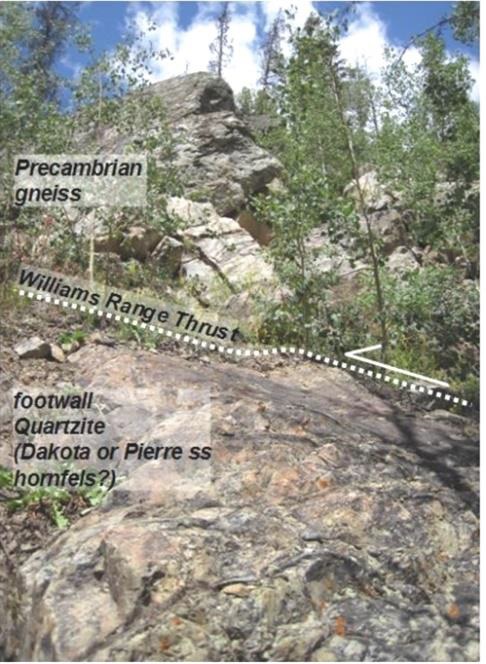
Structural Geology across Colorado
Ned Sterne, an independent professional geologist has recently been working with Colorado Geologic Survey, USGS, and Denver Museum of Nature and Science.
Ned has been working on the Colorado Transect: a restorable cross section following I-70 across Colorado incorporating data from the mantle to the mountain tops.
Below: Restoration before deformation and shortening
=
November
Geothermal Energy
Thursday, November 15, 2018
Jeff Winick, Geothermal Consultant

Abstract: Jeff’s talk will provide an introductory overview of geothermal energy, with topics that include the formation and characteristic elements of geothermal resources, and the basic technologies used to discover and develop them for a range of applications (electric and non-electric utilization). Jeff will also provide a high-level overview of the changing US electricity market, some key drivers and challenges, and the role that geothermal energy can play in this energy transformation.
Biography: Jeff Winick has more than 18 years of experience in energy, mineral, and water resource management. This includes leading technical teams, interdisciplinary project management, and international experience in development and operations. His technical specialization is in the collection, analysis, and interpretation of geochemistry data as a decision-making tool in multiple industry settings. Jeff works for Allegheny Science and Technology and is currently on contract to the US Department of Energy where he is the lead author and project manager for the GeoVision study. The study establishes a vision for growth of the U.S. geothermal industry based on R&D advancements in cost reduction, improved performance across geothermal resources and technologies, and techno-economic analysis of industry growth scenarios out to the year 2050. Jeff holds a master’s degree from New Mexico Tech and a bachelor’s degree from Franklin and Marshall College.
=
Geothermal Energy Potential of Colorado
Jen Livermore, Consulting Geothermal Engineer
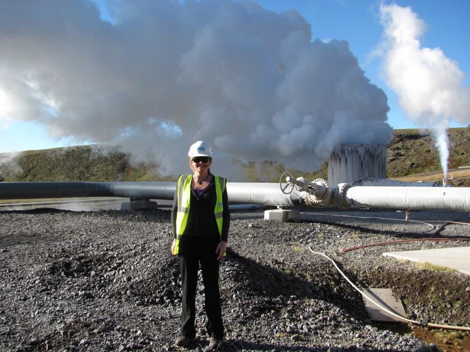
Abstract: Jen will discuss the geothermal energy potential of the state of Colorado. She will provide a regional overview of Colorado’s geothermal prospectivity based on its geological and structural setting. Specific hydrothermal systems will be highlighted with information regarding the geothermal system’s conceptual model based on desktop studies. The current status of geothermal development in Colorado for both direct-use applications and utility-scale geothermal projects will be presented.
Biography: Jen Livermore is a consulting geophysical engineer with a specialization in electrical and electromagnetic geophysical methods for natural resource exploration. Primary areas of geoscientific focus include deep imaging of geothermal systems utilizing the magnetotelluric method and direct-use applications of geothermal resources. Jennifer received a BS in Geophysical Engineering from the Colorado School of Mines in 2006, attended the inaugural National Geothermal Academy at the University of Nevada Reno in 2011, and completed an MS in Global Energy Management from the University of Colorado Business School in 2014. She is currently a board director of the Geothermal Resources Council industry group and an advocate for the geothermal industry.
=
December
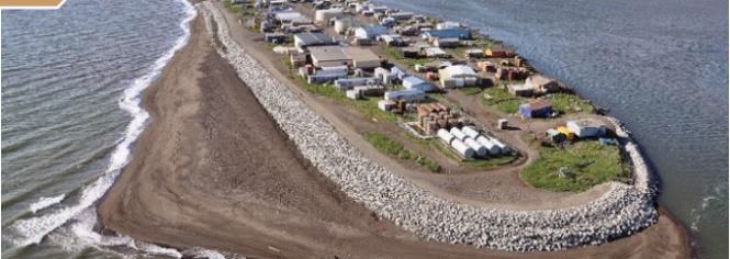
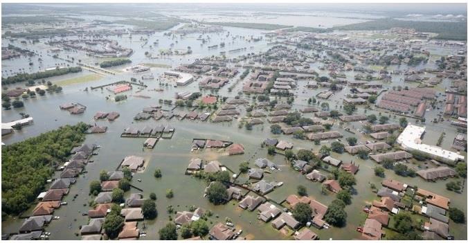
Cities, and a World, at Risk
Tuesday, December 11, 2018
Dr. Bob Raynolds, Denver Museum of Nature and Science and outgoing CSS President
with the DMNS Space Science Curator Dr. KaChun Yu using the Gates Planetarium to present this global story
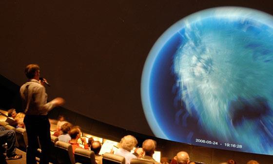
Gates Planetarium at Denver Museum of Nature and Science
Whence and Whither?
Chapter 1: Origins
While we may not have been literally born in the African Rift Valley, our ancestor’s bones are found here because of the propitious coincidence of favorable environments for living and for fossil preservation—coupled with great outcrops and sixty years spent collecting and studying the remains.
Examined in detail, most of our ancestors appear to walk into the stratigraphic tape recorder having done much of their evolution elsewhere (we know not where). Recent finds in caves in South Africa (Starr Cave) and in the Georgia Republic (D’Manisi) tell us that our evolutionary pattern was very shrubby, rather than tree like. Paleoanthropologists are browsing in this shrubbery.
Over the last 4,000,000 years we made 4 quantum leaps: we learned to Speak, to Walk (3.6 MM), invented Tools(3.3 MM) and tamed Fire (ca. 2MM?).
Chapter 2: Leaving Africa and Developing Civilization
We left Africa in a steady dribble over the past few million years and settled in Eurasia. Only a few tens of thousands of years ago we wandered into the New World. The arrival of humans foreshadows the demise of charismatic mega-fauna again and again, a pattern so well and repeatedly documented that it has become difficult to deny cause and effect. We grew up to occupy the world, learning, discovering, sharing and teaching.
Over the past 10,000 years, we made 3 more quantum leaps: Agriculture/Domestication, Cities and Writing that carried us through to the eve of the Industrial Revolution; here tool making rose a quantum step with steam and hydrocarbons leading us to the gilded era: Model T Ford 1908.
Somewhere in here we phased into the Anthropocene….The era of accelerated extinctions and oil. Having climbed to ascendancy in the Anthropocene we can now ponder where we are headed.
Chapter 3: The internet in the Anthropocene; Wikipedia
Last 25 years, 1 quantum leap:
The latest big invention, the Internet has trumped all. We are achieving a global consciousness envisioned by De Chardin. The digital natives will lead us into a new world that we can only dimly discern, yet we can see some patterns and some components of the future.
Increased physical risks: This is Geology
The world is changing and the rate of change is changing leading to the Great Acceleration. The increased population is at risk due to pop growth in active areas, volcanoes, earthquakes, tsunamis, sea level rise, and storms. In the past ten years the population of the earth has increased by a billion people; equivalent to the population of the western hemisphere.
Increased social risks: This is the Politics of Desire
Fundamental and accelerating changes are afoot fueled by Fomo. Global connectivity has been achieved through the use of social media; some countries have more cell phones than people. Wikipedia is the most powerful tool invented by mankind. In the digital age, we are potentially vastly more effective at utilizing human capital. If Einstein were to be reborn in Sri Lanka he would probably be found.
Our civilization is at risk; geologists may be accused of not warning people.
Using the new tool kit, social media, Wikipedia, and drawing on the fullness of human knowledge through automated search bots, our children will find new ways forward, some completely unimaginable today. Second half of the chessboard; Importance of exponential growth.
Chapter 4: Energy is the lynchpin:
The trick is de-carbonizing it.
Water: pumping, purification
Light: education, reading at night
Transportation
Energy Transformation:
Grid-scale batteries
Hacking photosynthesis
Biofuels from algae (not corn!)
DOE and DOD are intensively studying, legacy of Energy Secretary Chu
End of oil is nigh (we have been saying this a long time but for the wrong reasons); Peak oil is countered by the McElvy Box….more tech, more money = more oil
De-Materialization; End of cameras, encyclopedias, phonographs, personal operated cars, vinyl records, videos, oil.
De-Monetization: End of taxis, end of banks, and end of credit cards?
Science offers solutions, we have adequate capacity, manpower and resources. Yet still we squabble and squander and watch the world wallow in misery. We are sentient beings recently empowered and networked with global instantaneous communication. Science has built our civilization. Science has propelled our population to beyond 7 billion. Science has elevated hundreds of millions from poverty during our lifetime—yet in the US, science is poorly understood by many.
The above has been accomplished amidst a tragedy of the commons. Beguiled by progress, we have inadvertently, but knowingly triggered and accelerated the sixth extinction. We condone a planetary lifestyle where over a billion people lack clean water and 800 million are malnourished. We flare methane in the Bakken, the Eagle Ford, the Persian Gulf, and Siberia through inefficient exploitation of oil. Our world receives more energy than it emits due to man-made modifications of the atmosphere. Ocean temperature and chemistry together with global climate patterns area changing because of our impact. We are helpless to repair the drought-amplified cultural chaos in Syria, Somalia, Sudan and the Sahel. Tens of millions of our fellows are migrating or are warehoused in refugee camps. Their disillusionment and disenchantment tarnishes us all.
Bob Raynolds, outgoing CSS President