Front Range Pleistocene Geomorphology and Mysterious Gravel Deposits
April 15, 2018
Leaders: Cal Ruleman (USGS), Bob Raynolds (Denver Museum of Nature and Science), and Beth Simmons (retired)
CSS 2018 Spring Field Trip flyer
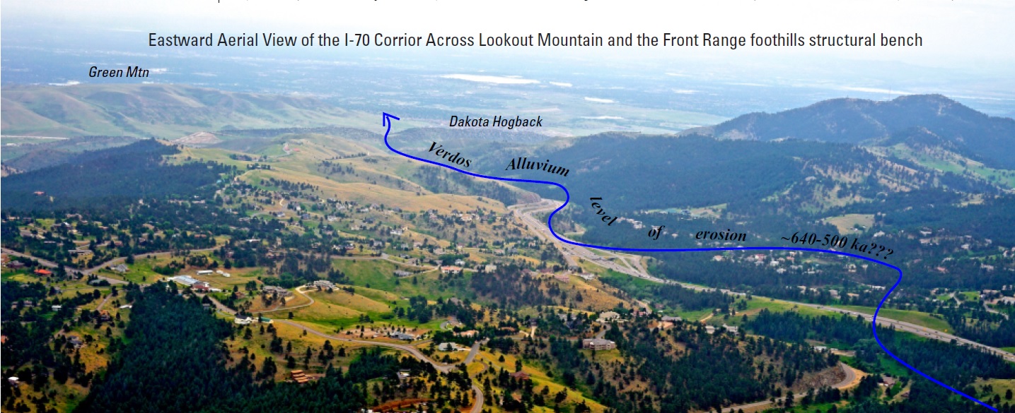
We explored several sites along the I-70 corridor and up along Highway 103 on the northeast shoulder of the Mount Evans massif. We began with an overview of the previous work within the area and relationships that have been previously established, from the Eocene Rocky Mountain erosional surface to Pleistocene incision rates and the timing for onset of major Pleistocene glacial epochs. After our meeting spot overview, our first stop was at the Genessee Park-I-70 junction with discussions pertaining to geomorphology east and west of the Floyd Hill Divide. We then went to the Casino Parkway and the large exposure of the Central City Gravel. Here we had time for personal observation of the deposit and geomorphic relationships. We discussed probable mechanisms for deposition and relationships to distal fan surfaces and chronologic relationships to the east on the Great Plains. We continued up Chicago Creek at Idaho Springs with stops at Last Glacial Maximum (Pinedale) moraines and till deposits for comparison with the Central City Gravel. Proceeding up Highway 103 to Echo Lake and Juniper Pass we observed geomorphic similarities between Bear and Clear Creeks with probable coeval glacial-induced landscape incision. Cal provided a new perspective for future investigations involving Pleistocene geomorphic development of the Rocky Mountain-Great Plains region.
On June 12, 2018 five of us looked at the wind gap in Dinosaur Ridge where Mount Vernon Creek is shown flowing before it was captured. See Inspect Wind Gap in Dinosaur Ridge to see what we found.