Talks at Colorado Scientific Society Meetings in 2022
Colorado Scientific Society’s 2022 World Rock Tour
January
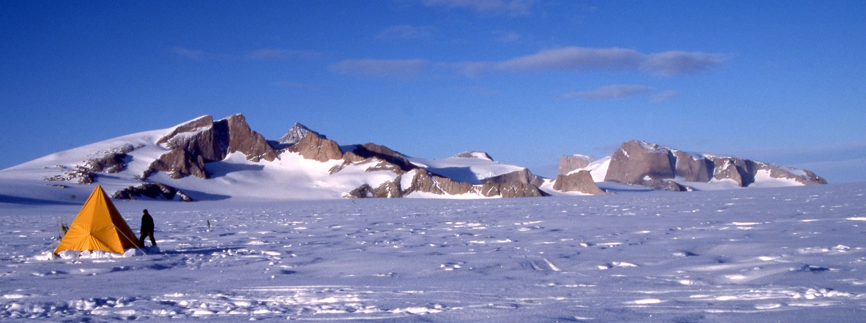
Antarctica, at the juncture of bedrock geology and dynamic ice sheet
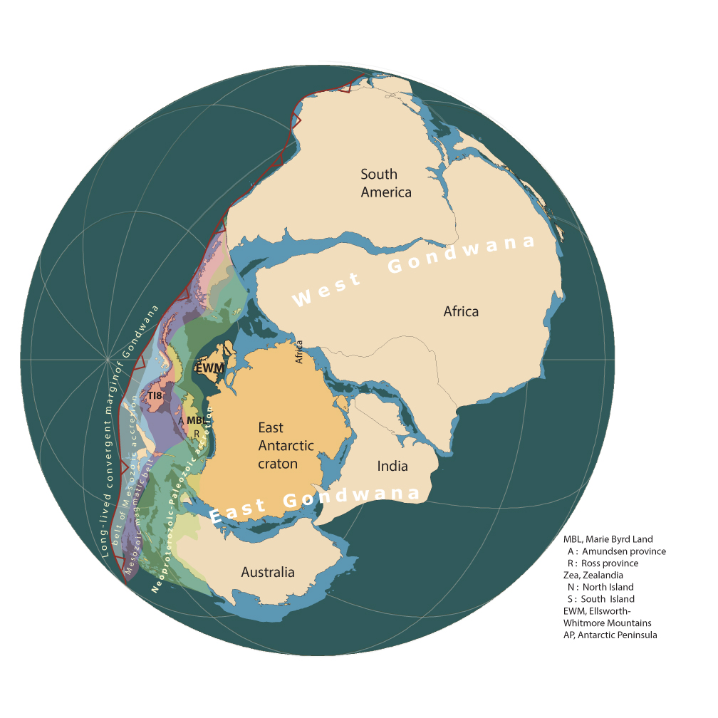
Part I : Continental growth along Gondwana’s active margin
Part II: Cores to Continent: New clues to the future “Pliocene world” that awaits us
Thursday, January 20, 2022
Christine Siddoway, Professor of Geology and Chair of the Geology Department at Colorado College
The link for a video of the meeting is after the images, Abstract and Bio.
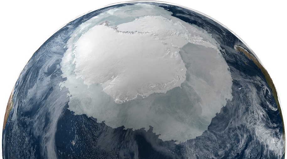
Abstract: What better way to begin the Scientific Society’s 2022 “World Rock Tour” than with a geological journey to the Southern Continent – a place that’s become less distant, owing to dire climate news from West Antarctica that arrives almost daily. The rapid decline of West Antarctic ice might cause an earth scientist to wonder, “What are the geological underpinnings of this continental ice sheet? Are there tectonic or terrain factors that contribute to ice dynamics? Has rapid deglaciation happened in the past, and if so when? under what conditions?”
This month’s seminar, presented in two parts, first explores the tectonic evolution, terranes, and topography of West Antarctica, then shares new perspectives on the origins of the West Antarctic Ice Sheet and fluctuations in ice sheet extent. Field photos and outcrop shots will illuminate the narrative.
In Part I, I’ll offer a geological account of continental crust formation, stabilization, then breakup along Gondwana’s active margin, drawing upon field-based studies of mid-crustal rocks of Marie Byrd Land, West Antarctica. MBL crust, and most of the continental crust of West Antarctica, formed entirely in the Phanerozoic, along the convergent margin of Gondwana that spanned Australia, Zealandia, West Antarctica and Patagonia. When the Gondwana supercontinent broke up, the final segment to open was West Antarctica – Patagonia, allowing the circum-Antarctic ocean to form, and placing the Southern continent in its icy state.
Part II of the seminar will share discoveries from current work on deep-sea sediment cores obtained by International Ocean Discovery Program Expedition 379 to the Amundsen Sea in 2019 (Siddoway participated). The sediments span from Pliocene to Present, and are yielding detailed climate records. The cores contain astonishing intervals of ice-rafted debris: coarse materials that can be linked to their sites of origin in the subglacial bedrock of West Antarctica. Some notable clasts signify an icesheet that was drastically reduced in extent, in mid-Pliocene time…. when the Earth’s climate last was as warm as it’s become, today. Knowledge of the geology of subglacial bedrock of West Antarctica is critical for tests of the “open interior seaway” hypothesis for Pliocene Antarctica.
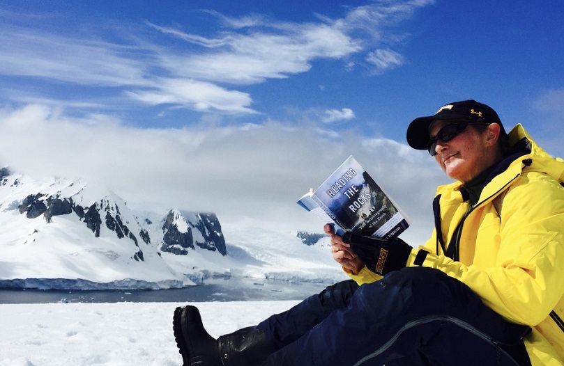
Bio: Christine Siddoway has travelled to Antarctica 15 times, thanks to numerous grants from the National Science Foundation and invitations from two European programs. A majority of her field work has been conducted in West Antarctica – a stormy region that has been avoided by most land-based geologists (volcanologists, excepted). She is Professor of Geology and Chair of the Geology Department at Colorado College. She’s been involved in the US Antarctic Research Program since 1989.
View Zoom Recording of “Antarctica, at the juncture of bedrock geology and dynamic ice sheet”
Watching this video is best in full screen. (This may sharpen up images.)

No passcode is needed to access this recording. Just click on the video.
Duration: 1:52:02
DISCLAIMER and FAIR-USE STATEMENT: The following Zoom-meeting recording contains content that expresses the opinions, viewpoints, and conclusions of the speakers and does not necessarily reflect the views, policies, or endorsements of the Colorado Scientific Society. This recording is made available to the public for general information and educational purposes only and is not intended to be used for profit. Any use of copyrighted material included therein for other purposes must obtain express written permission from the author.
=
February
Thursday, February 17, 2022
CSS had two talks this month.
Drivers, Disassemblers and Implications of flat slab subduction, Peru
Nadine McQuarrie, University of Pittsburgh
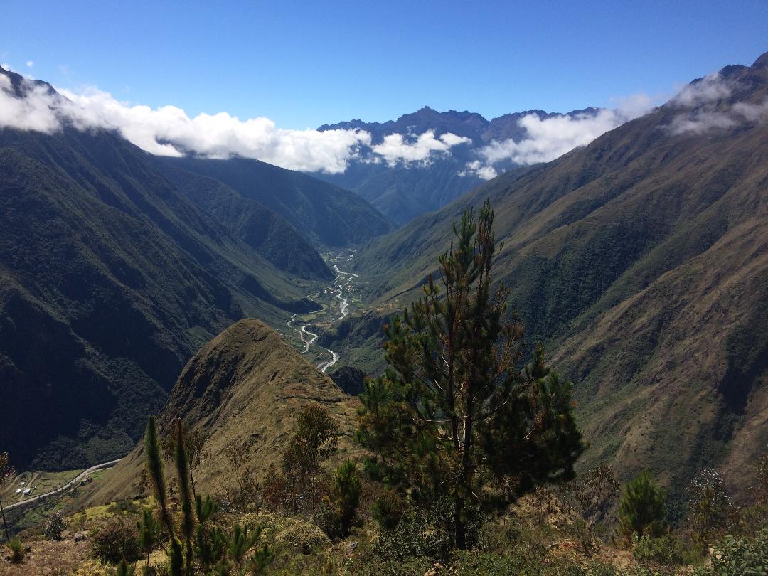
Abstract: Geophysical images of Andean flat slabs are natural laboratories in which to understand the existence and potential drivers of ancient flat slabs along the North and South American cordilleras. Near or fully flat slab subduction occurs along ~ 10 % of all subduction zones. The causes of flat slab subduction, the strength of coupling between the downgoing and overriding plates as well as the resulting effects on the upper plate continue to be debated. Two of the major drivers of modern flat slabs are thought to be, a) subducted buoyant oceanic plateaus/ ridges and/or b) trench retreat and resulting hydrodynamic suction within the mantle wedge that lifts and supports the subducting slab. Which of these two processes is dominant, depends strongly on the architectural (existence or not of buoyant oceanic ridges) and tectonic drivers (rate of overriding plates) present within the subduction system. While buoyant ridges are associated with both modern Andean flat slabs, they are missing from ancient Andean examples. Tectonic reconstruction of the Andes, constructed in a mantle reference frame illustrates the westward advance of the trench and retreat of the Nazca slab at ca. 2 cm per year since ca. 50 Ma. In the flat slab portions, trench retreat without rollback has occurred since their formation at ca. 12 Ma. This result lends strong support that advancing (towards the trench) upper plate motion creates an overpressured sub-slab mantle supporting the weight of the slab. Slab tears release pressure and allow for rollback. In southern Peru, directly south of the modern flat slab, patterns of magmatism argue for flat slab subduction from 45 to ca. 15 Ma, concurrent with the majority of shortening in the region. The return to steeper dips is associated with a marked slowing of shortening rates, and the propagation of the dramatic ca. 2-3 km deep canyons that are carved into the eastern Andean plateau.
Nadine McQuarrie is a Professor at the University of Pittsburgh. She received her Ph.D. at the University of Arizona in 2001 with an emphasis in Structure and Tectonics. She was a Post-Doctoral Scholar at California Institute of Technology from 2001-2004 and an Assistant Professor at Princeton University before accepting a position at the University of Pittsburgh in 2011. Dr. McQuarrie spent a year at Tuebingen University in Germany as an Alexander von Humboldt Research Fellow (2011-2012). She studies the geometric, kinematic and erosional evolution of mountain belts particularly in the Himalaya and the Andes. Current research focuses on linking the geometry and kinematics of mapped structures to thermochronometer cooing ages and landscape evolution models to examine the interplay between tectonics and erosion on deformation, exhumation and the resulting morphology of mountain ranges
=
No recordings of this meeting were made.
Thursday, February 17, 2022
Mesa Verde and Machu Picchu – Ancient Water Management in Differing Climates
Andrew Earles, Wright Water Engineering
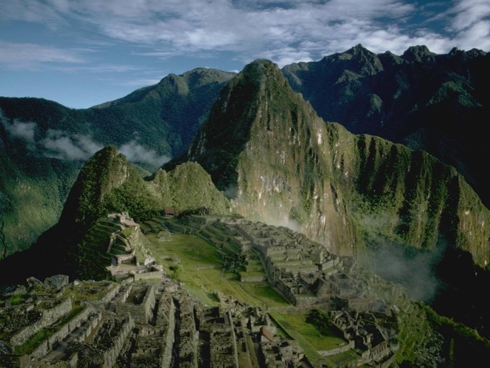
Abstract: Mesa Verde and Machu Picchu are iconic ancient sites in the Americas that tell stories of the sophistication of water management techniques of the Ancestral Puebloans and the Inca. Mesa Verde in Southwestern, Colorado saw centuries of occupation and societal evolution in an arid environment in part due to water systems that collected and stored water during wet periods for use during dry periods. Machu Picchu, on the other hand, has a much wetter climate and milder fluctuations in seasonal temperatures than Mesa Verde; however, it is set on a graben high above the Urubamba River and relies on groundwater as a primary source for canals and fountains in dry weather.
Dr. Earles will present some of the highlights of ancient water management systems at Mesa Verde and Machu Picchu and discuss similarities and differences in water management techniques and the role of water in these societies. The presentation will show examples including several reservoirs and a cistern at Mesa Verde and the Inca Spring and canal and fountain system at Machu Picchu.
Dr. Andrew Earles, P.E. is the Vice President of Water Resources with Wright Water Engineers in Denver Colorado. He is a Professional Hydrologist and Diplomate of the American Academy of Water Resources Engineers. Andrew’s professional practice evolves around hydrology, hydraulics, drainage, water quality, and water resources. Andrew is a Research Associate with the Wright Paleohydrological Institute and has conducted work around the world in Peru, Cambodia, Thailand, Myanmar, China, and Iraq related to understanding and preserving cultural and historical resources. Andrew earned his bachelor’s degree in engineering at Stanford University and master’s and doctoral degrees at the University of Virginia.
No recordings of this meeting were made.
=
March
Thursday, March 17, 2022
CSS had two talks this month:
Comparing Stratigraphic Architecture and Petroleum Systems Across the South Atlantic Margin
Katie-Joe McDonough, PhD. KJM Consulting, Consulting Geologist/Geophysicist
Atlantic Volcanoes: Activity in 2021 and challenges for geoconservation
Tom Casadevall, US Geological Survey, Scientist Emeritus
Here are the presentations:
Comparing Stratigraphic Architecture and Petroleum Systems Across the South Atlantic Margin
(with a brief look at crustal evolution as time permits)
Katie-Joe McDonough 1, 2, Friso Brouwer 1, 3, Brian W. Horn 1, Kyle R. Reuber 1
1. ION E&P Advisors, Houston, TX, United States
2. KJM Consulting, Pine, CO, United States
3. I^3 GEO, Denver, CO, United States
Abstract: Extensive offshore areas of the South Atlantic eastern and western continental margins remain underexplored, despite significant recent hydrocarbon discoveries. Recent discoveries and tests attest to functioning petroleum systems on both sides of the conjugate South Atlantic margin, in reservoirs ranging from near-shore shelf carbonates to deep-water siliciclastic reservoirs. South of the salt provinces, offshore Brazil, Uruguay and Argentina host multiple underexplored basins. Exploration wells drilled along the conjugate African margin support that Early and Late Cretaceous petroleum systems exist in this area. Source-reservoir couplets and plays identified on each of the margins suggest that petroleum habitats emerging on one margin potentially exist on the other side as well.
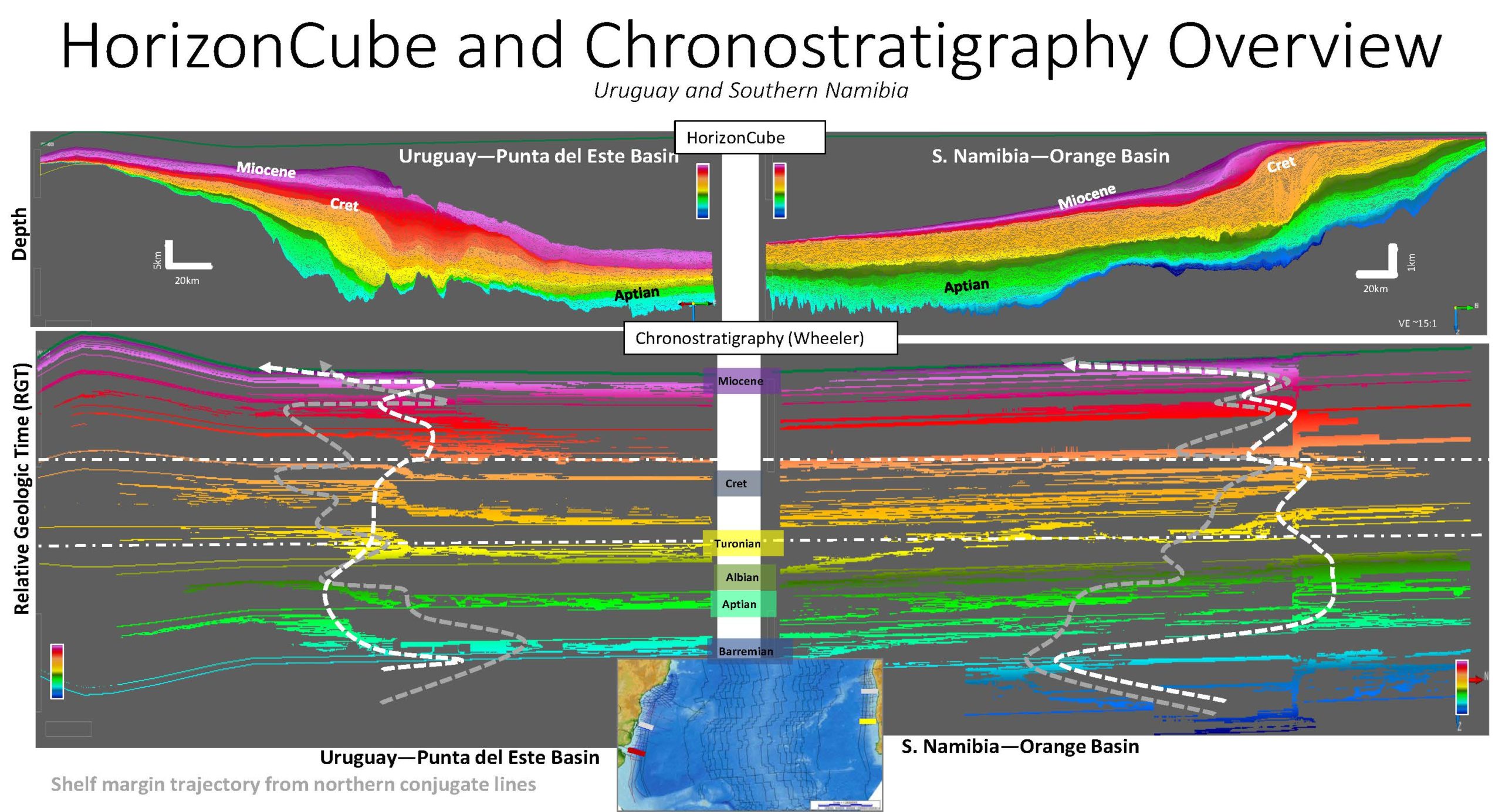
We use long-offset, long-record 2D seismic lines (> 400 km in length!) shot by ION Geophysical for the purposes of investigating the South American offshore continental margin. We compare the stratigraphic evolution of continental margins on opposite sides of the South Atlantic Ocean. South America and Africa began to drift apart with the Early Cretaceous opening of the Atlantic Ocean. We generate detailed chronostratigraphic interpretations—HorizonCubes—in dGB OpendTect from four seismic profiles offshore Brazil, Uruguay and the conjugate margin of northern and southern Namibia. The four HorizonCubes depict high-resolution stratal architecture and evolution of the post-rift sequences as the South Atlantic margins drifted apart. We compare HorizonCubes to document similarities and differences on the margins, relate these to petroleum system evolution, and predict other potential hydrocarbon fairways. We integrate results of thermal maturity modeling to further hone the play fairways where source, reservoir and appropriate maturity history coincide.
Prior to rifting and opening of the South Atlantic, the margins shared a similar geologic evolution. During Aptian/Albian time, marine anoxic source rocks were deposited on both margins in distal settings as the margins stepped landward. These source rocks are juxtaposed with synchronous lowstand systems which are productive in Namibia but not yet in Uruguay. Stratigraphic architecture on each of the opposing margins naturally began to diverge with increasing separation of the continents. On the Turonian Uruguayan margin, two-phase shelf margin aggradation gave rise to shelf reservoir buildups and slope-failure-related deep water reservoirs, with intervening condensed source rocks. The contemporaneous Namibian margin experienced similar two-phase aggradation with steeper shelf profiles, which gave rise to more persistent lowstand development in deep water Namibia. The synchronous lowstand at the K-T suggests simultaneous large-scale (global) regression on both margins. The rest of the Tertiary, shows increasing cycle asynchroneity, with high-resolution T-R cycles on the lower-gradient Namibian shelf. The Miocene sections shows the most disparity in architecture, with simultaneous regression in Namibia and transgression in Brazil.
Our comparison demonstrates that variation in stratigraphic architecture dictates predictable variation in reservoir/trap configurations. Our evolving understanding of petroleum systems on both sides of the South Atlantic suggests that developing joint stratigraphic frameworks on both sides of the Atlantic aids depositional history interpretation and identification of play types and models.
As time permits, we will also touch briefly on the evolution of the Earth’s crust below the sedimentary fill in this area of the South Atlantic. We note similarity of textural features in the “basement” rocks—the continental and oceanic crust below the offshore sedimentary basins.
Katie-Joe McDonough, PhD., is a Denver-based geological/geophysical consultant specializing in seismic & sequence stratigraphy and multi-disciplinary integration. She focuses on multi-scale stratigraphic analyses and process sedimentology for exploration play assessment and reservoir-scale development. Katie Joe began her career as a geophysicist with Exxon USA, which kindled her interest in seismic sequence stratigraphy. She launched her consulting practice in 1997 (after realizing that she enjoyed working paper seismic sections on her 8-ft Lyons SS kitchen bar!) She has since enjoyed over 23 years of working diverse, multi-scale data sets on five continents for worldwide and domestic petroleum industry clients. She serves as an industry mentor to local YPs and to CSM graduate students. In B.C. times, Katie Joe taught face-to-face client Sedimentology/Stratigraphy workshops, and like most of us has converted those to remote.
=
Katie-Joe’s presentation was not recorded because it contained proprietary information.
Thursday, March 17, 2022
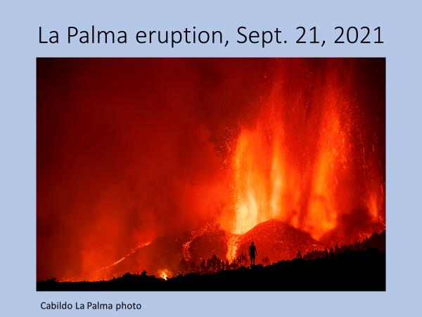
Atlantic Volcanoes: Activity in 2021 and challenges for geoconservation
Tom Casadevall, US Geological Survey, Scientist Emeritus
Abstract: During 2021 there were 80 eruptions from 75 different volcanoes around the world. Three of the longest-lived eruptions in 2021 occurred in the North Atlantic region at Fagradalsfjall, in Iceland; at the Soufriere – St. Vincent in the Lesser Antilles; and at La Palma in the Canary Islands, Spain. All three eruptions were well monitored by national geological agencies and the eruptions attracted unusually large global followings thanks to easy access for visitors and remarkable coverage on social media sites. Both Fagradsfjall and La Palma volcanoes lie within UNESCO designated protected areas. The Fagradsfjall volcano lies within the Reykjanes Global Geopark. La Palma volcano lies within the La Palma Biosphere Reserve. Portions of Soufriere – St. Vincent have been identified for inclusion in both World Heritage and Biosphere Reserve areas.
Fagradalsfjall volcano, Iceland, and it’s associated eruptive activity started eruption on March 19, 2021 following several months of heightened seismic activity in the Reykjanes Peninsula along several strands of the Mid-Atlantic rift. The eruption ended on September 18, 2021. Located close to the Keflavik International Airport and to the Icelandic capital of Reykjavik in an uninhabited area, the eruption drew approximately 350,000 visitors to the site. The eruption produced mostly fluid pahoehoe and Aa type lava flows with little associated volcanic ash. The principal volcanic hazard was due to volcanic gases which generally stayed in valleys and low-lying areas along which visitors walked to view the activity. No casualties were reported from the eruption.
Soufriere – St. Vincent volcano in the Lesser Antilles began eruption December 27, 2020 and ended on April 21, 2021. The volcano is one of 7 Caribbean volcanoes with eruptions since the start of the 20th century and was most realty active in 1979. The main volcanic hazard was from ash fall on local communities and minor mud flows (lahars). More than 8,000 people were temporarily evacuated from their homes due to the activity.
La Palma volcano on the island of La Palma, Canary islands, Spain, entered into eruption of September 19, 2021 following several weeks of mild seismic activity below the Cumbre Vieja summit. The eruption ended on December 15, 2021. La Palma is an intraplate volcano which lies above the east Atlantic hot spot. In addition to slow-moving Aa lava flows and mild Stombolian explosive activity, the La Palma eruption also produced large clouds of sulfur dioxide-rich gases. While there were no recorded causalities from the eruption, more than 3000 structures (homes, schools, churches, stores, etc) were destroyed.
Active volcanoes pose a special challenge for managers of protected sites such as Global Geoparks, Biosphere Reserves, and World Heritage areas. In 2021, nearly a third of the world’s active volcanoes were located within such protected areas.
Area of Responsibility and Current Responsibility or Research:
Thomas Casadevall’s scientific interests focus on mineral resources related to volcanic environments; on active volcanism and the related hazards to people and aviation operations; and on geologic heritage with an emphasis on protected volcanic landscapes. He currently leads the U.S. Geoheritage Advisory Group and recently completed the report “World Heritage Volcanoes” for the IUCN (International Union for the Conservation of Nature).
https://portals.iucn.org/library/sites/library/files/documents/2019-020-En.pdf
Tom is a member of the International Union for the Conservation of Nature (IUCN) World Commission on Protected Areas and its Geoheritage Specialist Group. A newly published report on guidelines for identifying “Geological World Heritage” can be found at:
https://doi.org/10.2305/IUCN.CH.2021.12.en
Accomplishments:
From 1996 through 2008, Tom served in the Office of the Director, USGS with terms as Regional Director for the Western Region (1996-1997), as Acting Director of the USGS (1998), as Deputy Director (1999-2000), and as Regional Director, Central Region (2000-2008). From 1978 to 1996, he worked as a geologist with the USGS Volcano Hazards Program, stationed at the Hawaiian Volcano Observatory, the Cascades Volcano Observatory, the Alaskan Volcano Observatory, and in Denver, Colorado. From 1989 through 1996 he led the USGS project “Volcanic Hazards and Aviation Safety”. From 1985 through 1988 he was Advisory Volcanologist to the Volcanological Survey of Indonesia and resided in Java, Indonesia. In 1977-1978 he taught geology of volcanic environments at the Escuela Politecnica Nacional in Quito, Ecuador. From 1969-1972 he worked as a mineral exploration geologist with Bear Creek Mining Company and from 1972 and 1974 as production geologist for the Sunnyside gold mine, Silverton, Colorado.
Tom served as President of the Colorado Scientific Society in 2019.
View Zoom Recording of “Atlantic Volcanoes: Activity in 2021 and challenges for geoconservation”
Watching this video is best in full screen. (This may sharpen up images.)
No passcode is needed to access this recording. Just click on the video.
Duration: 0:51:35
https://drive.google.com/file/d/1VI73HCM4Dz0N4TdK_1t381NhuCQMsjFH/view?usp=sharing
DISCLAIMER and FAIR-USE STATEMENT: The following Zoom-meeting recording contains content that expresses the opinions, viewpoints, and conclusions of the speakers and does not necessarily reflect the views, policies, or endorsements of the Colorado Scientific Society. This recording is made available to the public for general information and educational purposes only and is not intended to be used for profit. Any use of copyrighted material included therein for other purposes must obtain express written permission from the author.
=
April
Thursday, April 21, 2022
CSS had two talks this month:
Intra-plate tectonics in Southern Africa
Jim Granath, Consulting Structural Geologist
Seeking ancient man in the Turkana Basin
Evolution of geological mapping in the Turkana Basin, Kenya: from lines to dots to digits
Bob Raynolds, Denver Museum of Nature and Science
Here are the presentations:
Intra-plate tectonics in Southern Africa
Jim Granath, Consulting Structural Geologist
For a full-size image of Horizontal slickenlines along a major lineament in Namibia, click here.
Abstract: The Central and West African rift and shear system (WAS & CARS) has been a well-known hydrocarbon producing trend in northern Africa for some time. These are essentially Cretaceous-aged basins that collectively form the third arm of the Africa-South America breakup in the formation of the Atlantic, centered on the mouth of the Niger River. In recent years, my colleague Bill Dickson and I have used WAS/CARS as an analogy for a synthesis of Karoo (Permo-Triassic) tectonics in southern Africa that transcends the continent from well-known Karoo rifts in Tanzania, Malawi, Zambia, and Zimbabwe to the Atlantic coast in Namibia. Aeromagnetic inversion, gravity, and earthquake seismological data outlined a system of such basins that stretches under Kalahari cover in western Zambia, Botswana, Angola, and Namibia where the system daylights in the Waterberg Basin and several other deeply incised occurrences of Karoo. This westernmost Karoo is more deeply exposed than in East Africa because of its Mesozoic and Cenozoic regional uplift that largely unroofed and completely obliterated the rift sedimentary architecture. The only remnant is offshore of Walvis Bay where Clemson et al. (Geol. Soc. London, 1999) identified a Karoo rift system under the Cretaceous passive margin under the transition from the Walvis to the Lüderitz Basins. This is not to be confused with the Namibe Basin of Angola and Namibia, which is another element of the West African passive margin.
The cross-continental trend was termed STARSS for ‘Southern Trans-African Rift and Shear System.’ A fundamental feature of them is that they generally follow the trend of Pan-Africa fold belts, and use fault systems of that age in the basement as transfer faults connecting the rifts, and allowing distributed extension more or less in a ENE-WSW direction. The reactivation of these features has accentuated them so that they are prominent enough to have acquired various names, and a reputation for controlling subsequent deformation (Daly et al., Geol. Soc. London, 1989). Recent drilling by ReconAfrica has established that the rift is filled with Karoo sediments in NE Namibia, and seismic data confirmed the existence of previously unknown Karoo rifts in that area. Granath & Dickson (S&D, 2017) termed this the ‘Kavango Basin,‘ distinguishing it from the Owambo Basin to the west, which is the foreland basin for the sub-Kavango Pan-African orogenic belt (the Damara).
Earthquake data and some subsurface work in northern Botswana indicate that neotectonic activity is again utilizing these features to step East-African style extension westward. This is reflected in both clustering of epicenters near the lineaments and in the style of the few focal mechanisms that reflect the system’s kinematics. Recurrent North American intra-plate deformation may be informed by its African cousin.
Dr. James W. Granath is a consulting structural geologist based in Denver, Colorado, who has worked in academia and industry. Since 1976 he has taught at SUNY Stony Brook (1976-1981) and spent 18 years with Conoco Inc. in research, international exploration, and new ventures (1981-1999). In 1999 he opened a consulting practice focused on structural geology and tectonics as applied to exploration problems, interrupted only by brief periods of exclusivity with Forest Oil and Midland Valley Exploration in Denver. He is a member of AAPG, GSA, AGU, and RMAG, and is a certified petroleum geologist (#5512). He is the author of numerous research papers and co-edited several multi-author compendia. His expertise lies in seismic interpretation and integration with structural analysis, fracture analysis, regional synthesis, and prospect and play evaluation. Jim has worked on projects in some 40 countries around the world. Recent notable projects have included the Karoo rifts in Africa, the Kurdistan, Chiapas, and Oaxaca fold & thrust belts, and the Colorado Rockies. He holds his PhD from Monash University in Australia, and a BS and MS from of University of Illinois at Champaign-Urbana. Since 2019 he has been on the Board of Directors of Reconnaissance Energy Africa.
View Zoom Recording of “Intra-plate tectonics in Southern Africa”
Watching this video is best in full screen. (This may sharpen up images.)
No passcode is needed to access this recording. Just click on the video.
Duration: 0:41:45, duration including Bob Raynolds’ talk 01:31:29
DISCLAIMER and FAIR-USE STATEMENT: The following Zoom-meeting recording contains content that expresses the opinions, viewpoints, and conclusions of the speakers and does not necessarily reflect the views, policies, or endorsements of the Colorado Scientific Society. This recording is made available to the public for general information and educational purposes only and is not intended to be used for profit. Any use of copyrighted material included therein for other purposes must obtain express written permission from the author.
=
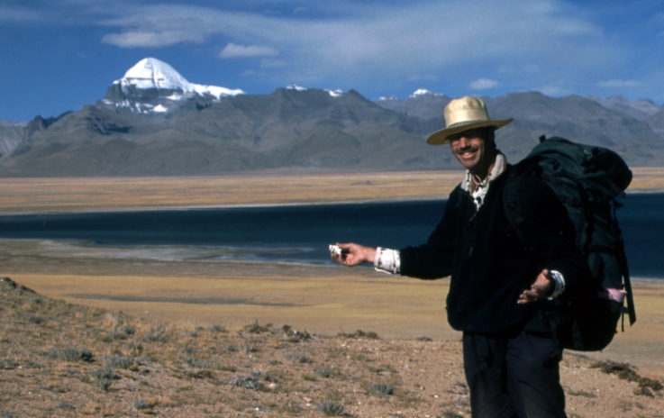
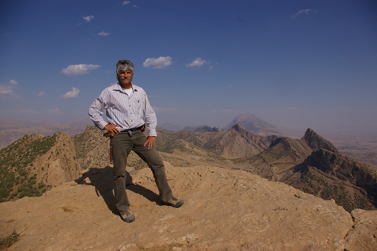
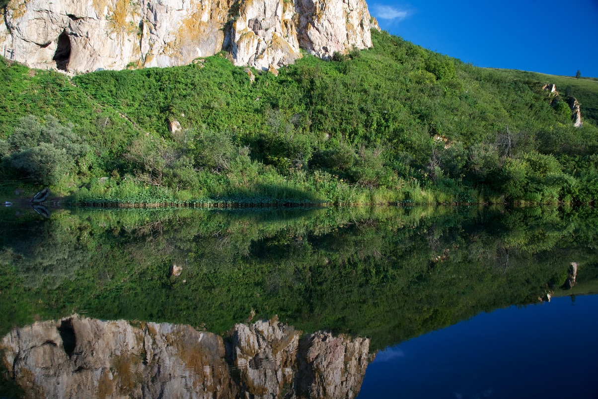
Seeking ancient man in the Turkana Basin
Evolution of geological mapping in the Turkana Basin, Kenya: from lines to dots to digits
Bob Raynolds, Denver Museum of Nature and Science
Evolution of geological mapping in the Turkana Basin, Kenya: from lines to dots to digits
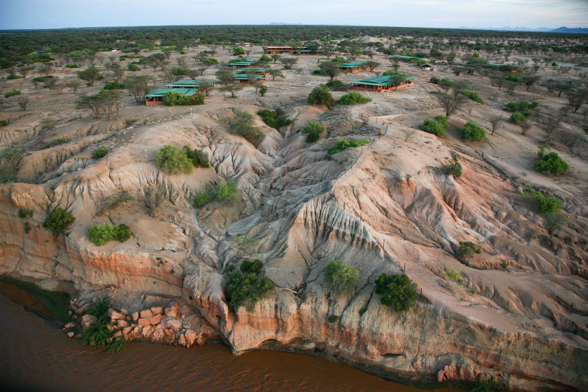
Abstract: This talk will present a history of geological mapping in a portion of the Eastern arm of the African Rift Valley in northern Kenya. Our discussion will use the history of mapping as a basis to share knowledge of the episodic extensional processes that have given us the modern geomorphology for which East Africa is so justifiably famous.
The Turkana Basin in NW Kenya hosts one of the richest troves of fossil remains of our ancestors on earth. It also harbors the earliest known stone tools and a myriad of archeological sites that document our cultural evolution and the morphological changes seen in the fossilized skeletal materials. The context of these fossils and tools is provided by the stratigraphy of the slowly filling rift valley. The exposure of these treasures is provided by the ongoing tilting and deformation of the rock layers by the active forces of continental extension.
After preliminary observations by explorers investigating the headwaters of the Nile, mapping of these sediments began in earnest in the 1960’s starting in the lower Omo Valley of Ethiopia. Mapping soon spread to Kenya where fossiliferous strata were discovered on the shores of Lake Turkana by Richard Leakey, son of the pioneering paleoanthropologists Mary and Louis Leakey. Later, Richard founded the Turkana Basin Institute with an academic base at Stony Brook University to coordinate multidisciplinary research in the region.
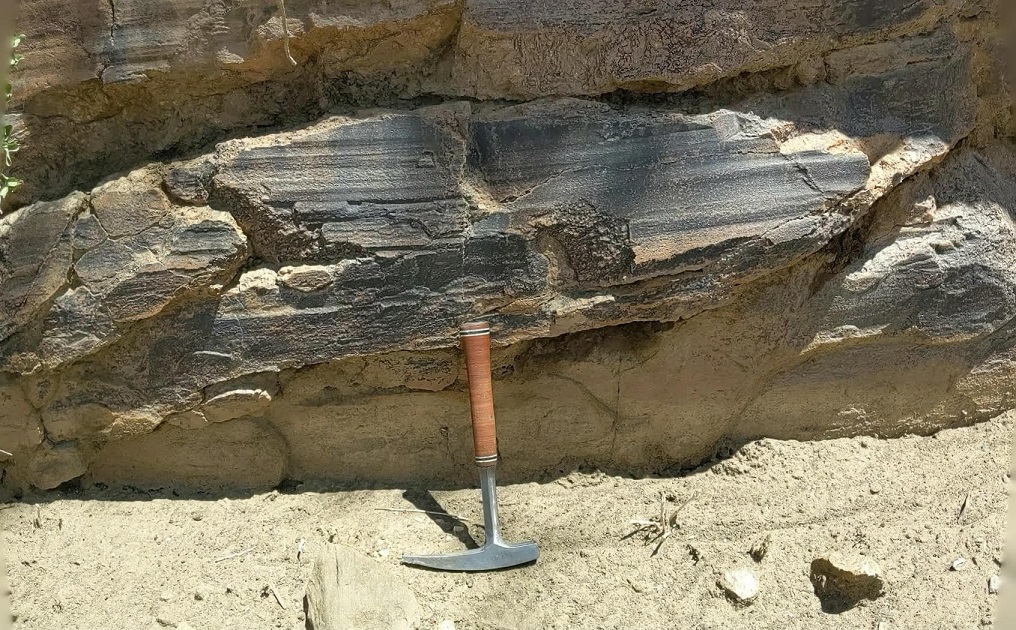
I started mapping geology of the Turkana Basin in 1972 as part of a senior thesis at Dartmouth College and did more detailed mapping with two classmates the following summer. We used enlarged black and white air photographs, mylar, and rapidographs. The sedimentary layers are punctuated by airfall volcanic ash beds that can be radiometrically dated and geochemically finger-printed. Complemented by magnetostratigraphy, a robust chronstratigraphic record has been compiled illustrating the waxing and waning of the lake through time and offering a solid basis for calibrating faunal evolution.
Piecemeal geological mapping by students and syntheses assembled by Frank Brown of the University of Utah provided the early framework for collecting bones and stones and remained in effect until the early 2000’s. I began to compile the existing maps using Google Earth and Adobe Illustrator in 2014. Five years later, I realized I would never accomplish my task as the region was too vast.
With funding from the Turkana Basin Institute, we embarked on a digital mapping campaign spearheaded by Geologic Data Systems in Littleton. In January of 2022 a series of new 1:30,000 scale geologic maps were completed by a team headed by Kathy Connors. Earlier this year I spent a month with Rutgers colleague Craig Feibel ground truthing these new maps. Both paper copies and digital tiles on the smart-phone app Avenza were used in the field. Hundreds of kilometers of remote terrain were covered and the maps proved to be both remarkably accurate and precise.
We now leave unborn generations of researchers with a robust geologic framework to use in their further research efforts, and I may sleep better at night.
Bob Raynolds is a consulting geologist who has lived in Denver for over 25 years. He earned his Masters in Applied Earth Sciences from Stanford University and his Bachelor’s and PhD from Dartmouth College. He has taught at the Center for Excellence in Geology at Peshawar University in Pakistan, at Dartmouth College, and at the Colorado School of Mines where he is presently an adjunct faculty member. Part of his responsibilities at CSM involve teaching applied field methods in geothermal exploration. Bob worked for the USGS in Menlo Park and in Reston, for Exxon Production Research in Houston, and for Amoco in Houston and Denver.
Bob is a Research Associate at the Denver Museum of Nature & Science where his dissertation research on the sedimentary rocks that accumulated at the foot of the Himalayas led him to study synorogenic strata in the Denver Basin that record the uplift of the Front Range. This has culminated in a series of publications focusing on both deformation history and the stratigraphic control on groundwater distribution.
He is Past-President of the Friends of Dinosaur Ridge and the Colorado Scientific Society. He has taught industry courses on rift valley and Western Interior Basin stratigraphy. He has taught short courses on water resources in China and in South America. His recent lectures focus on the character and integrity of the geological record and its role in helping us place into perspective the impact of environmental changes on Colorado’s ecology and water resources.
View Zoom Recording of “Seeking ancient man in the Turkana Basin; Evolution of geological mapping in the Turkana Basin, Kenya: from lines to dots to digits”
Watching this video is best in full screen. (This may sharpen up images.)
No passcode is needed to access this recording. Just click on the video.
Bob Raynolds’ talk starts at: 00:41:45, Duration of Bob Raynolds’ talk 00:49:42
DISCLAIMER and FAIR-USE STATEMENT: The following Zoom-meeting recording contains content that expresses the opinions, viewpoints, and conclusions of the speakers and does not necessarily reflect the views, policies, or endorsements of the Colorado Scientific Society. This recording is made available to the public for general information and educational purposes only and is not intended to be used for profit. Any use of copyrighted material included therein for other purposes must obtain express written permission from the author.
=
Spaceships, Fusion, and Intentional Inclusion
Thursday, April 28, 2022
Joy Dunn, Head of Operations for Commonwealth Fusion Systems
The Colorado Scientific Society and the Colorado School of Mines chapter of the American Institute of Aeronautics and Astronautics hosted Joy Dunn, Head of Operations for Commonwealth Fusion Systems, from 5:00 p.m. to 7:30 p.m on Thursday, April 28th in the Grand Ballroom in the CSM Student Center for a talk followed by a reception.
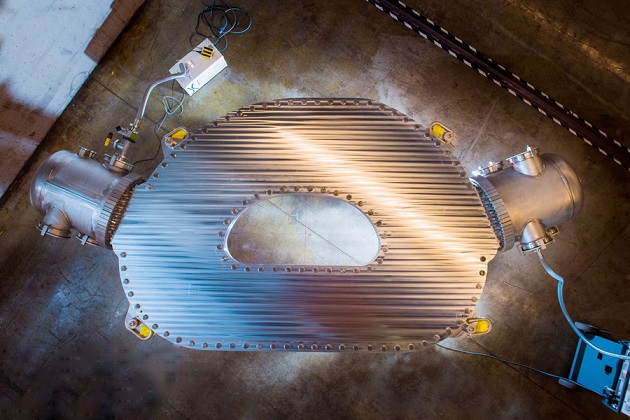
Abstract: Joy discussed her career journey across the aerospace and fusion industries and shared stories about scaling up manufacturing as an early-stage employee at both SpaceX and Commonwealth Fusion Systems (CFS). She also shared key lessons learned that have enabled SpaceX’s success and growth from a scrappy startup to an industry powerhouse and she provided insights into developing SpaceX’s cargo and crew spacecraft program. Joy dived into the background of fusion energy and CFS’ technological advancements to make net positive energy from fusion a reality by 2025. She shared details about the physics of tokamaks (magnetic confinement devices), scaling the company, and CFS’ plans to deploy 10,000 fusion power plants around the world to tackle our global climate change crisis.
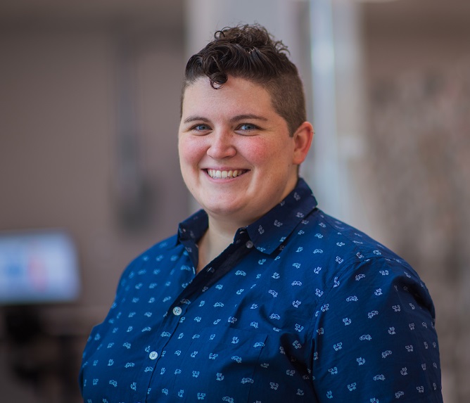
Joy Dunn is the Head of Operations at Commonwealth Fusion Systems (CFS), a clean energy startup based in Boston, where she is responsible for the company’s day-to-day operations including manufacturing, construction and facilities, safety, and quality. Supported by the world’s leading investors and a collaborative partnership with MIT’s Plasma Science and Fusion Center, the CFS team is driven by the climate change crisis to develop the fastest path to commercial fusion energy. In her previous role as Head of Manufacturing, Joy led the production of the world’s largest high-temperature superconducting magnet which successfully demonstrated the key technology needed to enable net-positive fusion energy. Before joining the CFS team in early 2019, Joy spent a decade at SpaceX developing and manufacturing the Dragon spacecraft to deliver cargo and astronauts to the International Space Station. Joy also co-founded both the Women’s Network and LGBTQ employee interest groups at SpaceX and she is actively involved in STEM outreach events, including sitting on the Board of Directors for Out For Undergrad, a non-profit that helps LGBTQ students reach their full potential. She was also named to Business Insider’s list of the Most Powerful Female Engineers of 2017 and to the World Economic Forum’s Young Global Leaders in 2018. Joy received her B.S. in Aerospace Engineering from the Massachusetts Institute of Technology.
View Zoom Recording of “Spaceships, Fusion, and Intentional Inclusion”
Watching this video is best in full screen. (This may sharpen up images.)
No passcode is needed to access this recording. Just click on the video.
Duration: 01:15:15
DISCLAIMER and FAIR-USE STATEMENT: The following Zoom-meeting recording contains content that expresses the opinions, viewpoints, and conclusions of the speakers and does not necessarily reflect the views, policies, or endorsements of the Colorado Scientific Society. This recording is made available to the public for general information and educational purposes only and is not intended to be used for profit. Any use of copyrighted material included therein for other purposes must obtain express written permission from the author.
=
May
Thursday, May 19, 2022
Structural Geology and Geological Exploration in the Indo-Burmese Ranges of NE India;
Deformation along a collisional/transform plate margin
Daniel Schelling, Structural Geology International, LLC
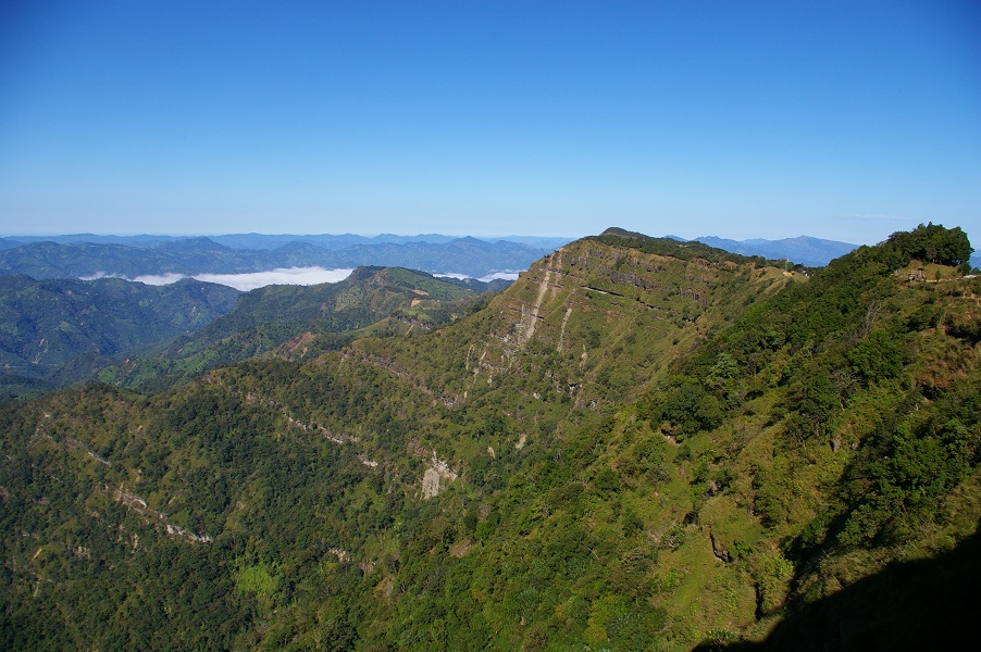
Abstract: While many professional and non-professional geologists are familiar with the geology and tectonic origins of the Himalaya, few geologists have had the opportunity to do field work and detailed geological studies along the southern extension to the Himalayan orogenic belt in Northeast India. Political and logistical issues have kept the mountain ranges and fold-thrust belt of Northeast India off-limits to both national and international geologists for most of the last 75 years. However, to a field and structural geologist the mountain ranges and fold-thrust belts of Northeast India are as interesting as the “type” location of continental collision tectonics along the central Himalayan arc, where it has been studied in Nepal, India and Northern Pakistan.
The talk presented here focuses on the structural geology of the Northeast India collisional plate boundary with Burma, and the northern sector of the 1200 km long Indo-Burmese ranges. The Indo-Burmese range of Northeast India includes two distinct, thin-skinned fold-thrust belts that are separated by the Shillong Plateau. To the north, the Upper Assam-Nagaland fold-thrust belt is characterized by a frontal, emergent imbricate-fan where the thrust belt overrides the Brahmaputra foreland basin, and an internal structural zone along which multi-kilometer-thick thrust sheets and underlying duplex systems have accommodated up to 100 km of tectonic shortening. To the south, the Manipur-Mizoram sector of the fold-thrust belt is defined by an up to 100 km wide frontal fold-train along which tight, symmetric to asymmetric detachment folds, faulted detachment folds, and/or fault-propagation folds have been mapped. The internal sectors of the Manipour-Mizoram tectonic zone include complexly deformed fold-trains and associated thrust faults that have undergone significant uplift along an underlying tectonic wedge that I have interpreted as a tectonic-scale passive-roof duplex. A structural transition zone that separates the northern and southern sectors to the fold-thrust belt has been identified along the east-plunging nose to the south-vergent, basement-cored Shillong Plateau Anticline, where the fold-thrust belt impinges upon this basement high. During the talk we will look at multiple geological cross sections to help understand the underlying geological, structural and tectonic architecture of the Indo-Burmese ranges in Northeast India. The difficulties and fun of working in this sub-tropical mountain range will also be illustrated with photographs of the mountains, villages and people in a part of the world that remains unknown to most Indians and non-Indians alike.
Daniel Schelling is a structural geologist who has worked in fold-thrust belts and mountain ranges around the world and on multiple continents over the last 40 years. Dan received a Ph.D. from the University of Colorado in 1989 where he wrote a dissertation on the structural evolution of the Eastern Nepal Himalaya, a study that involved close to 3 years of field work in Nepal. Since 1989 Dan has worked as both a university professor and an independent consultant for the oil and gas industry, with research focused on the structural styles and evolution of fold-thrust belts, and the construction of balanced structural cross sections. In addition to having done extensive geological field work and research along the fold-thrust belts that define the northern margin of the Indian subcontinent in Nepal, India and Pakistan, Dan has worked in the Middle East, Central Asia, Europe, Africa, South America, and North America.
View Zoom Recording of “Structural Geology and Geological Exploration in the Indo-Burmese Ranges of NE India;
Deformation along a collisional/transform plate margin”
Watching this video is best in full screen. (This may sharpen up images.)
Proprietary seismic data is covered in three places.
No passcode is needed to access this recording. Just click on the video.
Duration: 01:21:38
DISCLAIMER and FAIR-USE STATEMENT: The following Zoom-meeting recording contains content that expresses the opinions, viewpoints, and conclusions of the speakers and does not necessarily reflect the views, policies, or endorsements of the Colorado Scientific Society. This recording is made available to the public for general information and educational purposes only and is not intended to be used for profit. Any use of copyrighted material included therein for other purposes must obtain express written permission from the author.
=
September
Thursday, September 15, 2022
CSS 2022 Past Presidents’ Dinner
The White Sands footprints — humans in North America 23,000 years ago
Jeff Pigati and Kathleen Springer, US Geological Survey
Dinner and presentation at the Mount Vernon Canyon Club
24933 Clubhouse Circle, Golden, CO (on Lookout Mtn., off I-70)
Ancient human footprints in White Sands National Park and their link to abrupt climate change
Jeffrey S. Pigati1, Kathleen B. Springer1, Matthew R. Bennett2, David Bustos3, Thomas M. Urban4, Vance T. Holliday5, Sally C. Reynolds2, Jeffrey S. Honke1, Vincent L. Santucci6, Daniel Odess7
1U.S. Geological Survey, Denver Federal Center, Box 25046, MS 980, Denver CO 80225, USA.
2Institute for Studies in Landscapes and Human Evolution, Bournemouth University, Poole, BH12 5BB, UK.
3National Park Service, White Sands National Park, P.O. Box 1086, Holloman AFB, NM 88330, USA.
4Department of Classics and Cornell Tree Ring Laboratory, Cornell University, Ithaca, NY 14853, USA.
5School of Anthropology, P.O. Box 210030, University of Arizona, Tucson, AZ 85721, USA.
6National Park Service, Geologic Resources Division, 1849 C Street NW, Washington, DC 20240, USA
7National Park Service, Cultural Resources Directorate, Washington, DC 20240, USA.
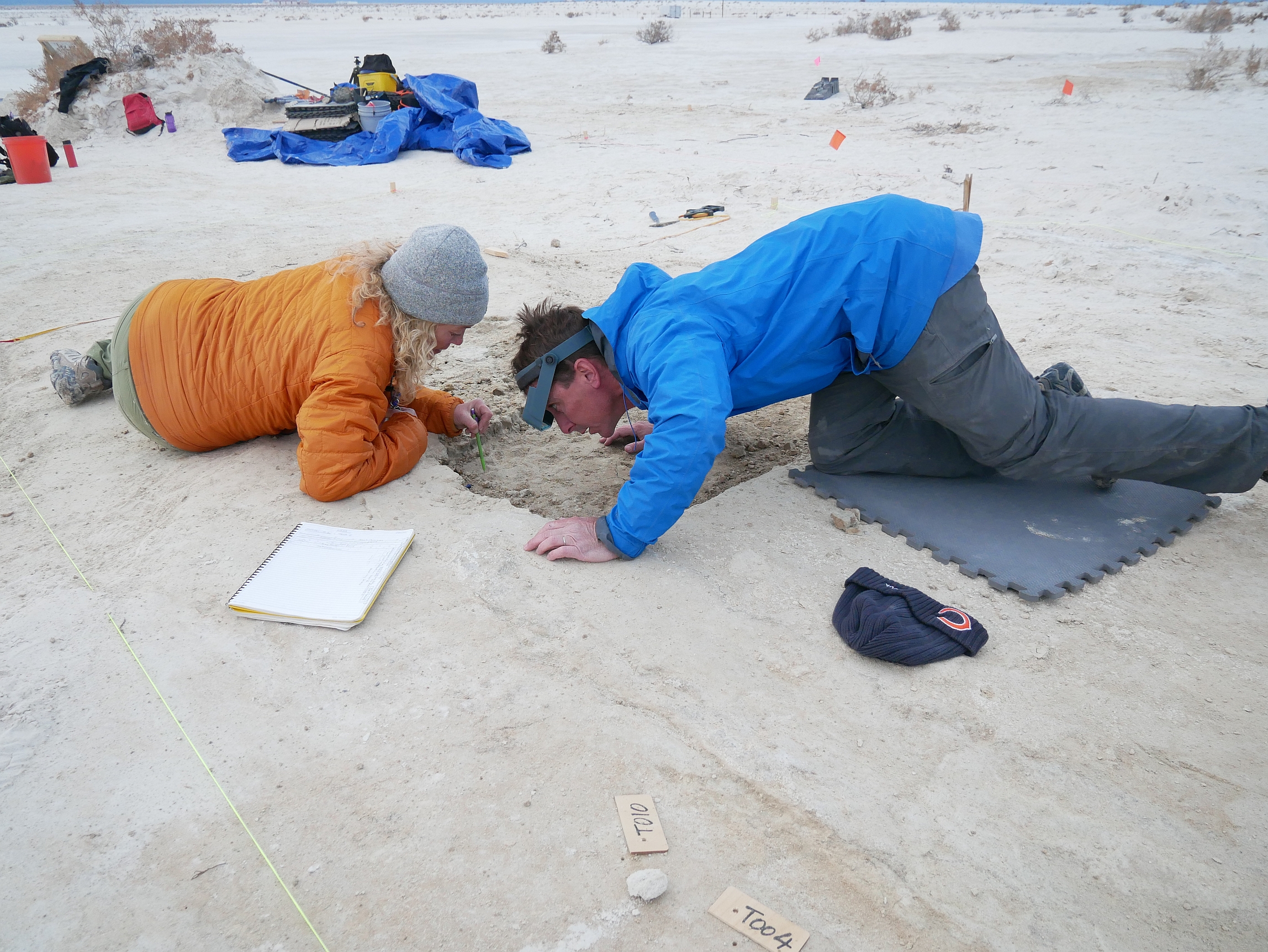
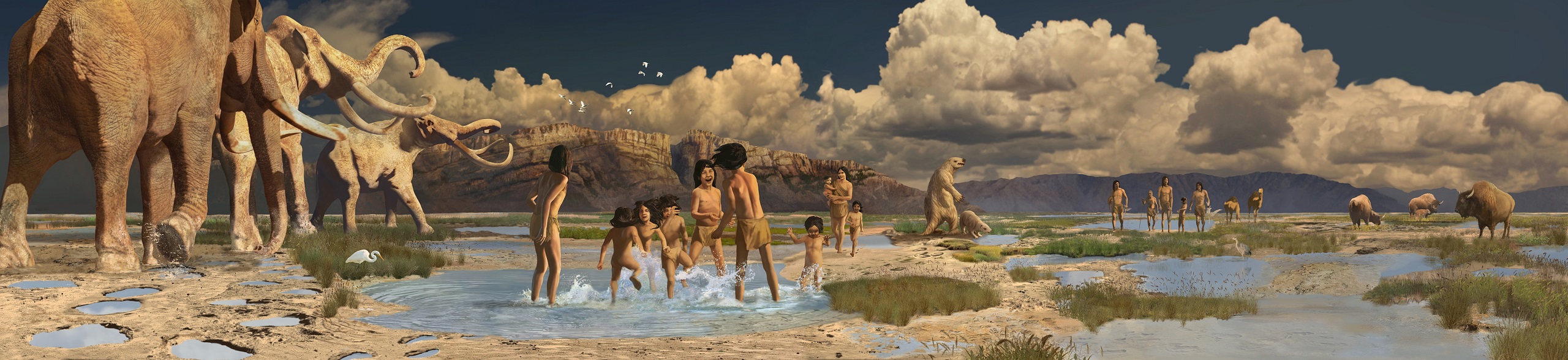
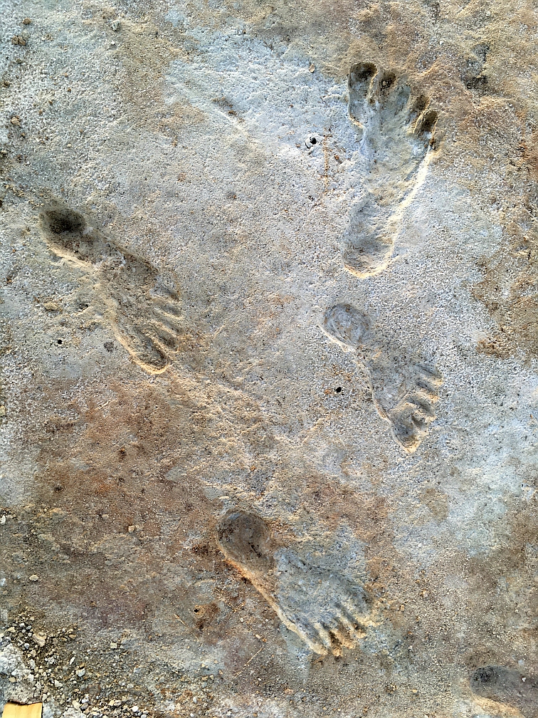
Abstract: A multidisciplinary team of scientists recently announced the discovery of the oldest human footprints in North America. These fossilized prints were made between 23,000 and 21,000 years ago along the shores of an ice age lake that once filled the Tularosa Basin in south-central New Mexico, in what is now White Sands National Park. This finding fundamentally changes the timeline on North American human habitation – turning back the clock of human arrival in the Americas many thousands of years. What were the circumstances of this remarkable find, what allowed these footprints to be preserved and discovered, and importantly, who made them? During the late Pleistocene, full glacial conditions were interrupted repeatedly by abrupt warming events called Dansgaard-Oeschger, or D-O events. In the southwestern U.S., D-O events caused centuries-long megadroughts, which devastated spring ecosystems, lowered lake levels, affected sea-surface temperatures and ocean circulation patterns, and even triggered seismic activity. In the Tularosa Basin, lake levels dropped dramatically during D-O 2 at ~23,500 years ago, exposing an expansive lake margin. Humans and megafauna then walked across the patchwork of wet and dry ground, leaving behind footprints and trackways that were preserved in multiple sediment layers over the course of time. To date, a total of 61 footprints, mostly from teenagers and children, have been excavated from five distinct horizons that span nearly two millennia. These new discoveries, whose creation and preservation were made possible by an abrupt climatic event, confirm that humans were present in North America during the Last Glacial Maximum, adding evidence to the antiquity of human colonization of the Americas and providing a temporal range extension for the coexistence of early inhabitants and Pleistocene megafauna.
Jeff Pigati and Kathleen Springer are research geologists with the U.S. Geological Survey’s Geosciences and Environmental Change Science Center in Denver, Colorado. They are co-PIs of the Quaternary Hydroclimate Records of Spring Ecosystems project in which they investigate geologic deposits associated with springs and desert wetlands to determine how these fragile ecosystems responded to past episodes of abrupt climate change. Their work has focused on developing stratigraphic and chronologic frameworks from paleowetland deposits throughout the Mojave Desert and southern Great Basin, which then serve as hydroclimate roadmaps for these ecosystems. They have established that spring and desert wetland ecosystems are incredibly sensitive to changes in climate at multi-decadal to centennial timescales and that they expanded and contracted in near lockstep with changes in climate recorded in the Greenland ice cores over the past 40,000 years. These sensitive groundwater dependent ecosystems allow them to evaluate the effects of abrupt warming events on terrestrial landscapes including Dansgaard-Oeschger (D-O) events, which are analogous to projected future warming in terms of their magnitude, timing, and sphere of influence. Notably, their results demonstrate that springs and wetlands in the southwestern U.S. contracted or disappeared altogether during D-O events due to rapid groundwater lowering associated with these megadrought episodes. Their findings have tremendous implications for extant springs in arid environments.
Their research is largely conducted on federal lands administered by the National Park Service, including Tule Springs Fossil Beds National Monument, Death Valley National Park, Joshua Tree National Park, Channel Islands National Park, and the Mojave National Preserve. In White Sands National Park, Kathleen and Jeff have combined detailed stratigraphic analyses and cutting-edge dating techniques with their intimate understanding of past climate events to establish the age, geologic context, and paleoenvironmental setting of ancient human footprints recently discovered there – including the link to abrupt climate change that allowed the human and megafaunal footprints and trackways to be created and preserved. Their results have upended traditional models regarding the peopling of the Americas and fundamentally change the very foundation of North American archaeology.
See Fossilized Footprints on the White Sands National Park website.
A preview of the PBS Nova episode, Ice Age Footprints.
(You can view the full episode if you are a PBS member.)
View Zoom Recording of “The White Sands footprints – humans in North America 23,000 years ago”
Watching this video is best in full screen. (This may sharpen up images.)
No passcode is needed to access this recording. Just click on the video.
Duration: 01:30:26
DISCLAIMER and FAIR-USE STATEMENT: The following Zoom-meeting recording contains content that expresses the opinions, viewpoints, and conclusions of the speakers and does not necessarily reflect the views, policies, or endorsements of the Colorado Scientific Society. This recording is made available to the public for general information and educational purposes only and is not intended to be used for profit. Any use of copyrighted material included therein for other purposes must obtain express written permission from the author.
=
October
Thursday, October 6, 2022
CSS 2022 Emmons Lecture
Assessing the role of the Deccan Traps in the end-Cretaceous mass extinction
Blair Schoene, Princeton
In Room 241 of Berthoud Hall on the Colorado School of Mines campus
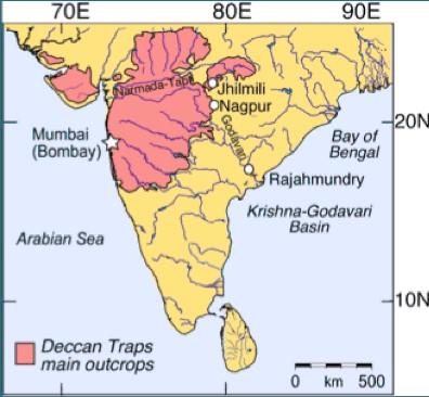
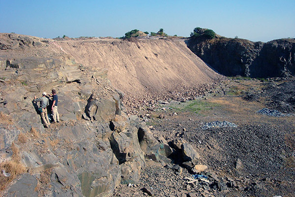
Abstract: The end-Cretaceous mass extinction is the only extinction event known to correlate with both volcanic activity from a large igneous province and a meteorite impact. Given the strong correlation between other mass extinction events and large igneous provinces, we have been carrying out high-precision U-Pb geochronology to establish the rates of eruptions across the extinction interval. Our work has shown that the vast majority of the Deccan Traps eruptions occurred within 1 Myr as series of large pulses that bracket the meteorite impact and mass extinction. While this work has substantiated and added details to the idea that volcanic pulses could have affected climate and contributed to the mass extinction, there remain large uncertainties in terms of magmatic and thermogenic volatile release, volumes of erupted lava, and the preserved geology of the province. Further quantifying these uncertainties should be a target of future work in order to understand how the Earth system responded to catastrophic volcanism, a meteorite impact and ecosystem collapse.
Blair Schoene is a Professor in the Department of Geosciences at Princeton University, where he is a geologist and geochronologist. His research investigates the rates and timing of geologic events throughout Earth history, from understanding volcanic and tectonic processes, to correlating mass extinction events with the possible causes and consequences. He got a B.S. in 1999 from The Colorado College, and a PhD from the Massachusetts Institute of Technology in 2006. Following a 3-year postdoc at the University of Geneva, Switzerland, he joined the faculty at Princeton, where he has been director of an isotope geochemistry and geochronology lab that focusses on high-precision U-Pb geochronology. His work on the Deccan Traps and the end-Cretaceous mass extinction began in 2013 and has resulted in numerous scientific publications, some of which have been featured in numerous media outlets, including the Washington Post and the New York Times.
Professor Gerta Keller had originally planned to give this presentation for us, but a health emergency for her has made this impossible. Her colleague and research team member at Princeton, Dr. Blair Schoene, will give the presentation instead.
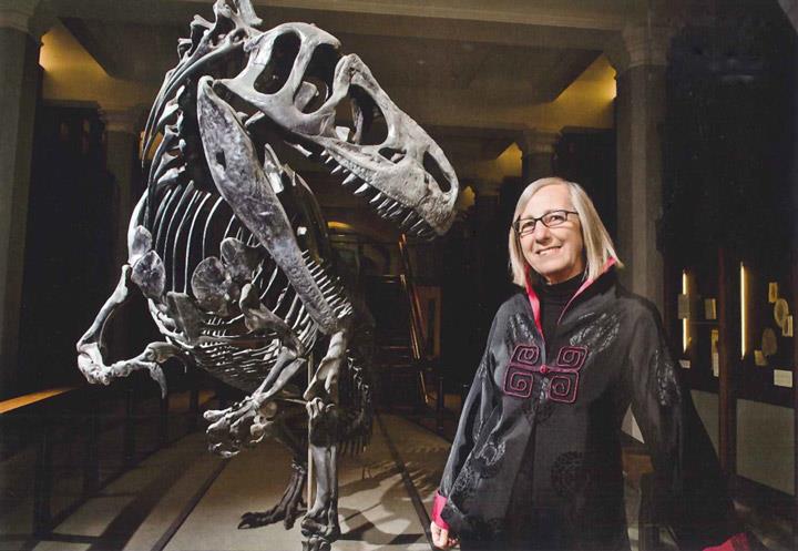
Gerta Keller is Professor of Paleontology and Geology in the Geosciences Department of Princeton University since 1984. She was born in Schaan, Liechtenstein and grew up in Switzerland. She is a citizen of Switzerland, Liechtenstein and the United States of America. She received a B.S. degree from San Francisco State University in 1973 and a Ph.D. degree from Stanford University in l978. Dr. Keller is currently Professor of Geosciences Emeritus at Princeton.
Keller’s primary research interests focus on major catastrophes in Earth’s history in the broadest sense, including the biotic effects of catastrophes, such as mass extinctions, meteorite impacts, major volcanic eruptions, rapid climate changes and ocean acidification. Her research integrates paleontology, stratigraphy, geochronology, sedimentology and geochemistry in reconstructing past environmental changes associated with or leading up to mass extinctions.
Keller is well known for her contributions to the Cretaceous-Tertiary mass extinction controversy. She has contributed in diverse areas, including a global quantitative analysis of the nature, rate and tempo of the mass extinction, stratigraphy and age control, climate and sea level changes, the distribution and age of diverse ejecta material related to impacts and Deccan volcanism. Her latest work on Deccan volcanism has concentrated on age dating of the main eruptions at and near the KT mass extinction in India and documenting the effects of this volcanism worldwide. Her work is largely the result of interdisciplinary collaborations with an international team of scientists and students.
View Zoom Recording of “Assessing the role of the Deccan Traps in the end-Cretaceous mass extinction”
Watching this video is best in full screen. (It may sharpen up images.)
No passcode is needed to access this recording. Just click on the video.
Duration: 01:28:13
DISCLAIMER and FAIR-USE STATEMENT: The following Zoom-meeting recording contains content that expresses the opinions, viewpoints, and conclusions of the speakers and does not necessarily reflect the views, policies, or endorsements of the Colorado Scientific Society. This recording is made available to the public for general information and educational purposes only and is not intended to be used for profit. Any use of copyrighted material included therein for other purposes must obtain express written permission from the author.
=
November
Thursday, November 17, 2022
CSS 2022 Emmons Lecture
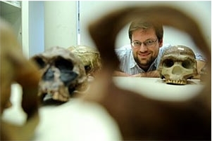
All in the (human) family: Neanderthals and Denisovans and us
Bence Viola, University of Toronto
Abstract: Over the last decade, the development of ancient DNA technology, allowing us to study the genetics of past populations, transformed our understanding of our origins. It became clear, that up until about 40,000 years ago our species was not alone on this planet but coexisted with several other human groups such as the Neanderthals, Denisovans and others. These populations interacted, and the genetical traces of these contacts still linger in us today.
In this talk, I will present some of the recent advances in our understanding of how these groups interacted both biologically and culturally. I will focus on Central Asia, especially the Altai Mountains, where these three populations, early modern humans, Neanderthals and the enigmatic Denisovans – a group only known from a few fragmentary fossils and their DNA – interacted. By combining ancient DNA, archaeological and morphological data we will look at the dynamics of these populations and explore these contacts.
Bence Viola: Dr. Viola is a paleoanthropologist focusing on the biological and cultural interactions between different hominin groups in the Late Pleistocene. After studying at the universities of Vienna and Bordeaux, he spent four years as a postdoctoral fellow at the Max-Planck-Institute of Evolutionary Anthropology in Leipzig and is now an Associate Professor at the Department of Anthropology, University of Toronto. Dr. Viola’s research uses an interdisciplinary approach combining morphological, archaeological and genetic data to better understand how the Neanderthals, their enigmatic Asian cousins, the Denisovans, and the first modern humans interacted. He has led excavations in Central Europe, East Africa and Central Asia, and is currently conducting fieldwork in Sel’ungur cave in Kyrgyzstan and at Grub/Kranawetberg in Austria.
View Zoom Recording of “All in the (human) family: Neanderthals and Denisovans and us”
Watching this video is best in full screen. (It may sharpen up images.)
No passcode is needed to access this recording. Just click on the video.
Duration: 01:37:15
DISCLAIMER and FAIR-USE STATEMENT: The following Zoom-meeting recording contains content that expresses the opinions, viewpoints, and conclusions of the speakers and does not necessarily reflect the views, policies, or endorsements of the Colorado Scientific Society. This recording is made available to the public for general information and educational purposes only and is not intended to be used for profit. Any use of copyrighted material included therein for other purposes must obtain express written permission from the author.
=
December
Tuesday, December 13, 2022
CSS December Potluck dinner, Annual Business Meeting, and President’s Address
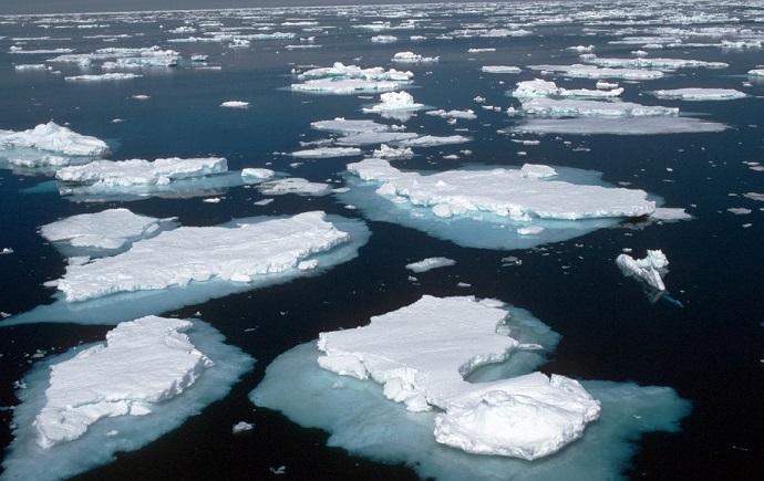
Who Owns the Arctic?
the Geopolitics of Plate Tectonics in a Melting World
Ned Sterne, Independent
We enjoyed a potluck dinner, our annual business meeting, and an in-person talk at the New Terrain Brewing Company
Who Owns the Arctic? – the Geopolitics of Plate Tectonics in a Melting World
Abstract: Due to rapid warming of the Arctic, summer ice cover in the Arctic Ocean has decreased by half since the 1980’s and may disappear completely in the next 10 years. While melting ice opens the Arctic to increases in transportation, resource exploitation and ecological change, it also heightens the potential for geopolitical conflict. Over the last 40 years, as the effects of climate change have become apparent, the United Nations Convention on the Law of the Sea (UNCLOS) has been engaged in a process whereby Arctic coastal states can submit claims to territories beyond their 200-nautical mile Exclusive Economic Zones (EEZ’s). Such claims hinge either on geology and geophysics to define the limits of continental shelves, or on ocean floor morphology to define subsea highs or “elevations” that are natural elongations of the geology of the neighboring continental shelf. Ideally plate tectonic models would clarify the geology; however, given the disparate proposals for the opening of the Arctic oceanic basins have different implications for what is continental versus oceanic crust, they complicate the UNCLOS process. Based on the UNCLOS submittals made to date by Russia, Denmark and Canada, it is clear coastal states seek to maximize their territorial claims, which opens their science to accusations of geopolitical bias. Further, the United States is not a party to UNCLOS, so it is not clear if or when the U.S. will submit a claim and what it might encompass. Given the overlapping claims submitted thus far, the Arctic coastal states will need to compromise and accept the boundaries established under UNCLOS – a favorable outcome clouded by the current tensions between Russia and the other Arctic coastal states.
In this talk, I will show a modification of the popular rotational plate tectonic model that pivots the Alaska, Chukotka and the New Siberian Islands away from the Canadian Arctic around a pole located near the Mackenzie River Delta. This work is based on Arctic plate tectonic studies I did for Amoco Production Company in advance of the 1988 Chukchi Sea oil and gas lease sale, and a 2013-2015 study I conducted with Katie-Joe McDonough and Jim Granath involving ~15,000 kilometers of deep crustal seismic on the East Russian Arctic Shelf for ION. One of the benefits of the UNCLOS process is it promotes the acquisition of new geologic information. I will discuss new Russian claims of continental crust underpinning the Alpha-Mendeleev Ridge, a subsea ridge bisecting the Eurasia Basin portion of the Arctic Ocean, problems with their preferred plate tectonic model, and what version of the popular rotational model might best accommodate such findings.
Ned Sterne received a B.A. in geology from Harvard in 1979 having finished a solo undergraduate honors thesis on the Indus-Tsangpo Suture Zone of Ladakh, northern India. He completed an M.A. in geology in 1981 at Dartmouth resulting in the discovery of ammonium illites associated with exhalative Pb-Zn-Ag ore deposits in northern Alaska. He did Rocky Mountain and international petroleum exploration from 1981 to 2015. Since retiring in 2015, he has been studying the geology of Colorado. Ongoing projects include showing how stacked triangle zones have built the thrusted basement uplifts of Colorado, the palinspastic restoration of a cross section following I-70 across Colorado, and illustrating how deformation of the Rocky Mountain Erosion Surface has rerouted rivers across Colorado and parts of neighboring states during the Cenozoic.
View Zoom Recording of “Who Owns the Arctic?; the Geopolitics of Plate Tectonics in a Melting World”
Watching this video is best in full screen. (It may sharpen up images.)
No passcode is needed to access this recording. Just click on the video.
Duration: 01:02:53
DISCLAIMER and FAIR-USE STATEMENT: The following Zoom-meeting recording contains content that expresses the opinions, viewpoints, and conclusions of the speakers and does not necessarily reflect the views, policies, or endorsements of the Colorado Scientific Society. This recording is made available to the public for general information and educational purposes only and is not intended to be used for profit. Any use of copyrighted material included therein for other purposes must obtain express written permission from the author.