Talks at Colorado Scientific Society Meetings in 2025
CSS January 2025 Meeting
Geologic Map Derivatives: From Pen and Paper to Digital Databases
Thursday, January 16, 2025 at 7:00 pm
Michael Frothingham, U.S. Geological Survey, Geosciences and Environmental Change Science Center
This meeting was held at Calvary Church Golden.
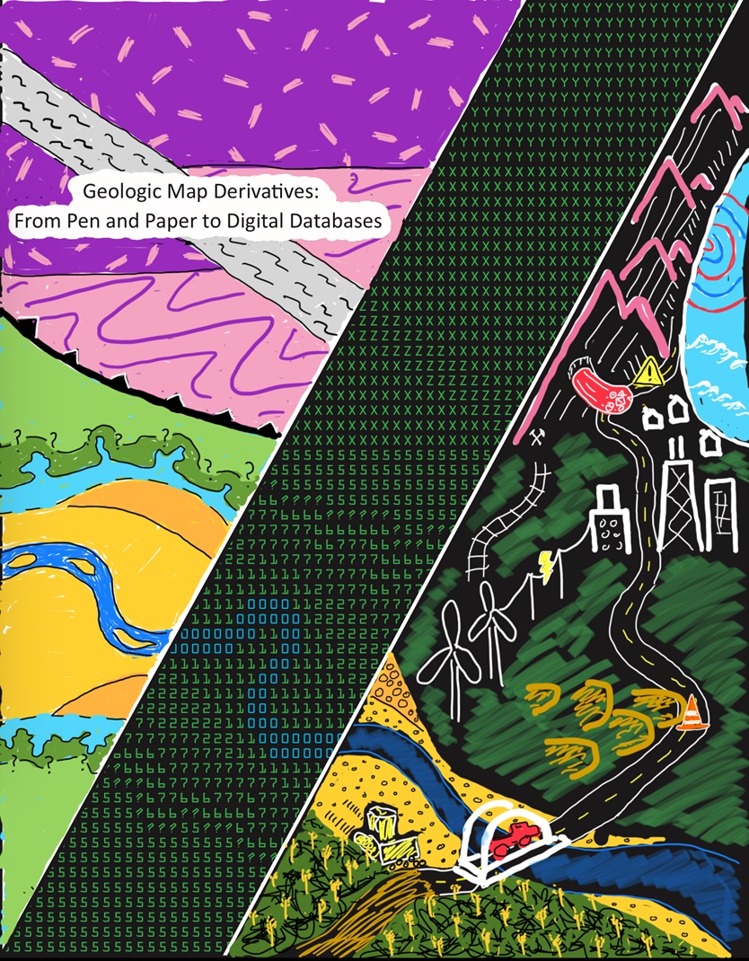
Geologic Map Derivatives: From Pen and Paper to Digital Databases
Abstract: Geologic maps are venerable hallmarks of earth science. While traditional pen and paper maps have impressively withstood the test of time, they are currently undergoing a revolution as maps are compiled into integrated databases. These new digital databases are becoming increasingly accessible and user friendly, with queryable data that enables new scientific applications and analysis. I present three examples of derivative geologic maps, generated from geologic map data compiled in the Seamless Integrated Geologic Mapping extension to the Geologic Map Schema (SIGMa GeMS). Using attribute queries and spatial intersections in a geographic information system, derivative maps are created from 1:100,000-scale geologic map compilations within the footprints of Cortez, Durango, Trinidad, and Aztec 1×2 degree quadrangles in Utah, Colorado, and New Mexico. The derivative maps include: (1) an aggregate and infrastructure map, (2) a sand dune/sheet and infrastructure map, and (3) a surficial mass wasting deposits versus bedrock geology map. These maps illustrate where aggregate resources (e.g., unconsolidated gravel and sand) occur relative to civil infrastructure, identify areas where mobile landforms (e.g., sand dunes or sand sheets) pose potential future risks to roads, and explore correlations between surficial mass wasting deposits (e.g., landslides, rockfalls, debris flows, etc.) and the underlying bedrock geology. These examples demonstrate the utility of modern geologic map databases, highlight opportunities for improving subsequent mapping, and inspire the development of future derivative maps to address pressing geological problems and societal needs.
Michael G. Frothingham, PhD, joined the USGS in 2022 as a part of the Geologic Framework of the Intermountain West project in Denver, Colorado. His interdisciplinary research involves collaborations among structural geologists and geophysicists to study how seismic waves interact with structural features such as faults, shear zones, plutons, and foliated rocks from Earth’s surface to the deep crust. Michael’s research tools include GIS geologic mapping, microscope petrography, Electron Backscattered Diffraction, quantitative structural analysis, geophysical modeling, and boots-on-the-ground field geology.
View Zoom recording of Colorado Scientific Society January 2025,
Geologic Map Derivatives by Michael Frothingham

No passcode is needed to access this recording. Just click on the video.
Duration: 00:56:38
Watching this video is best in full screen. (It may sharpen up images.)
DISCLAIMER and FAIR-USE STATEMENT: The following Zoom-meeting recording contains content that expresses the opinions, viewpoints, and conclusions of the speakers and does not necessarily reflect the views, policies, or endorsements of the Colorado Scientific Society. This recording is made available to the public for general information and educational purposes only and is not intended to be used for profit. Any use of copyrighted material included therein for other purposes must obtain express written permission from the author.
=
CSS February 2025 Meeting
Impact events: before, during, and after
Thursday, February 20, 2025
Catherine (Cat) Ross, CU-Boulder
This meeting was held at Calvary Church Golden.
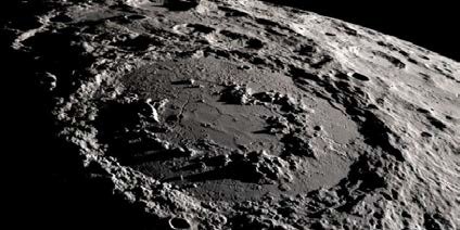
Abstract: The ~66-m.y. Chicxulub impact event vaporized target rocks of the Yucatán Peninsula and scattered debris around the world. These materials are useful in reconstructing the event itself, as well as a number of resulting geologic processes including earthquakes, tsunamis, and wildfires. In addition to better understanding events that lead to the extinction of the dinosaurs and many other lifeforms, researching crater processes can also provide insights into how life begins. As records of early Earth’s history, impact craters provide potential “cradles of life” that influenced the habitability of Earth’s earliest biotic environments. Because they are a ubiquitous planetary process, novel research being done on this planet will provide clues for similar cratering processes on other planets. This research is more important as sample return missions from the Moon and Mars are planned.
Keywords: impact cratering, planetary processes, mass extinctions, geochronology
Speaker Background: Dr. Cat Ross is an expert geologist with a specialty in thermochronology and uses thermochron and geochron to study impact craters. She currently is an NSF Postdoctoral Fellow at the Department of Geological Sciences, University of Colorado, Boulder. Her interests lie in investigating punctuated events throughout Earth history using field observations, geo-/thermos-chronology, microstructural analysis, and geochemistry.
Cat will start a faculty position at Baylor University Department of Geosciences in Fall 2025.
Flyer to post: CSS Lecture, Feb-25-2025, Cat Ross on Impact Events
View Zoom recording of Colorado Scientific Society February 2025, Impact events: before, during, and after by Cat Ross
No passcode is needed to access this recording. Just click on the video.
Duration: 01:01:38
Watching this video is best in full screen. (It may sharpen up images.)
DISCLAIMER and FAIR-USE STATEMENT: The following Zoom-meeting recording contains content that expresses the opinions, viewpoints, and conclusions of the speakers and does not necessarily reflect the views, policies, or endorsements of the Colorado Scientific Society. This recording is made available to the public for general information and educational purposes only and is not intended to be used for profit. Any use of copyrighted material included therein for other purposes must obtain express written permission from the author.
=
CSS March 2025 Meeting
A Pleistocene Sediment Mega-Pulse: Unraveling the mystery of the Chemehuevi Formation of the Colorado River
Thursday, March 20, 2025
Harrison Gray, U. S. Geological Survey, Luminescence Dating lab
This meeting was held at Calvary Church Golden.
Abstract: A lot has happened on planet earth over the past 200,000 years. Climate, erosion, and the distribution of people have all changed radically over that period. As scientists, we wish to know how, when, and why these changes occurred and to use this knowledge going forward. At the USGS luminescence dating lab, we use the physics of light, electrons, and minerals to figure out the “when.” Knowing how quartz and feldspar sand can store electrons within their crystal structure, we can measure these electrons to figure out how old a sample is. Using this knowledge, we consider a recent project: the enigmatic Chemehuevi Formation of the Colorado River.
Harrison Gray, PhD is a Research Geologist at the USGS Luminescence dating lab in Denver, Colorado. Harrison applies luminescence dating to various USGS projects including geologic maps, natural hazards and beyond. Recent projects include dating sand deposits of the Colorado River in and downstream of the Grand Canyon, creating new two-dimensional “age maps” using a portable luminescence reader, and helping determine the age of footprints at White Sands National Park.
View Zoom recording of Colorado Scientific Society March 2025
A Pleistocene Sediment Mega-Pulse: The Chemehuevi Formation of the Colorado River
No passcode is needed to access this recording. Just click on the video.
Duration: 00:44:39
Watching this video is best in full screen. (It may sharpen up images.)
DISCLAIMER and FAIR-USE STATEMENT: The following Zoom-meeting recording contains content that expresses the opinions, viewpoints, and conclusions of the speakers and does not necessarily reflect the views, policies, or endorsements of the Colorado Scientific Society. This recording is made available to the public for general information and educational purposes only and is not intended to be used for profit. Any use of copyrighted material included therein for other purposes must obtain express written permission from the author.
=
CSS April 2025 Meeting
Outstanding in the Field Since 1894: A Brief History of Brunton,
with an Update Regarding its New Ownership and Some Thoughts about the Enduring Importance of Analog Measurements
Thursday, April 17, 2025
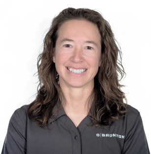
Lauren Heerschap, Co-Owner, CEO, Sales & Marketing Director

Brunton International LLC
www.brunton.com
This meeting was held at Calvary Church Golden.
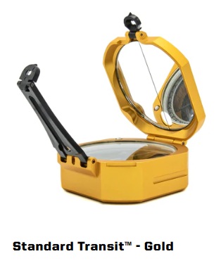

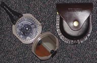
Brunton transits and compasses are made in Riverton, Wyoming, where Brunton has its headquarters.
See Brunton.com for more details about Brunton and their products.
Lauren Heerschap and her husband David designed and developed the Axis Transit. They are now co-owners of the Brunton Company. See more about their story at https://www.brunton.com/pages/about-the-owners
See this YouTube interview: Measuring Rocks – Brunton CEO Lauren Heerschap and find out how Lauren became co-owner and CEO of Brunton.
David W. Brunton – Colorado Scientific Society Member
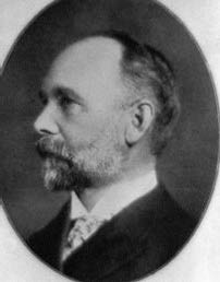
David W. Brunton was a Vice President of the Colorado Scientific Society from 1906-1908, and perhaps after that (records are incomplete). The following information is from History of the Colorado Scientific Society from 1882 through 2002 (PDF) on page 17:
“David W. Brunton (1849-1927) was a mining engineer. He invented the pocket transit, or Brunton compass, for miners and mining engineers; it has been used for many years by geologists doing geo-logic mapping. Brunton worked on the Toronto and Nipissing Railroad and at surveying and plotting several Colorado towns. He served as chairman of the board of engineers of the Moffat-Evans Tunnel Commission. He wrote a book on tunneling and published several papers on mining districts. Brunton was a member of several mining organizations in the U.S. and Britain. He was awarded medals for his achievements in the mining industry.”
Following the section about Brunton is a section on William Ainsworth, a watchmaker and jeweler. Brunton had Ainsworth manufacture his Brunton Pocket Transit under license. Ainsworth’s company continued to make Brunton’s transit, moving manufacturing to Wyoming in 1972.
View Zoom recording of Colorado Scientific Society April 2025
Outstanding in the Field Since 1894: A Brief History of Brunton, with an Update Regarding its New Ownership and Some Thoughts about the Enduring Importance of Analog Measurements
No passcode is needed to access this recording. Just click on the video.
Duration: 01:44:37
Watching this video is best in full screen. (It may sharpen up images.)
DISCLAIMER and FAIR-USE STATEMENT: The following Zoom-meeting recording contains content that expresses the opinions, viewpoints, and conclusions of the speakers and does not necessarily reflect the views, policies, or endorsements of the Colorado Scientific Society. This recording is made available to the public for general information and educational purposes only and is not intended to be used for profit. Any use of copyrighted material included therein for other purposes must obtain express written permission from the author.
=
CSS May 2025 Meeting and Emmons Lecture
The Consequences of the Compact Remains with Us:
Challenges and Opportunities for the Colorado River Upper Basin
Thursday, May 15, 2025
Eric Kuhn, retired general manager of the Colorado River Water Conservation District
This meeting was held at Calvary Church Golden.
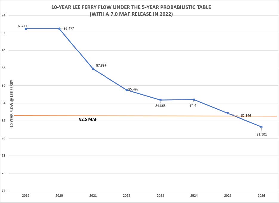
(With a 7.0 MAF Release in 2022)
Abstract:
Declining Colorado River flows are exposing critical ambiguities in the “Law of the River”, the interlocking set of Compacts, statutes, and court decisions that frame management of the river and the allocation of its waters. Perhaps most important among those is an apparent conflict between Article I of the Colorado River Compact, which calls for the “equitable division” of the river’s waters, and Article III, which is interpreted as creating a firm delivery obligation of water from the river’s Upper Basin to the Lower Basin. This apparent conflict has been papered over for decades with surplus water deliveries, but with climate change depleting the flow of the river, we are approaching a point where that is no longer possible, and a continuation of current practice would place the bulk of the burden of responding to climate change on the Upper Basin. That would hardly be “equitable”. We argue this places a burden on the Upper Basin to choose among a narrow set of paths forward – 1) continuing with the status quo in hopes of negotiating more favorable near-term rules, 2) taking a hard line with the attendant risk of litigation, or 3) seeking a more equitable long term agreement.
Keywords: Colorado River, Colorado River Compact, demand management, curtailment, Upper Basin obligations, water conservation
Download Science Be Dammed Working Paper Number 3, Kuhn, Eric and Fleck, John, from:
https://papers.ssrn.com/sol3/papers.cfm?abstract_id=4094375
Biography: Eric Kuhn is the retired general manager of the Colorado River Water Conservation District and co-author with John Fleck of Science Be Dammed: How Ignoring Inconvenient Science Drained the Colorado River, University of Arizona Press, 2019.
The Colorado River District is the largest and oldest of Colorado’s four conservation districts. It covers most of the Colorado River Basin within Colorado. Almost two thirds of the flow at Lee Ferry originates in or flows through the district. Eric started employment with the Colorado River District in 1981 as Assistant Secretary-Engineer. In 1996 he was appointed General Manager, a position he held until his retirement in 2018.
From 1994 through 2001, he served on the Colorado Water Conservation Board representing the Colorado River mainstem. Eric served as an at-large representative on the Colorado Inter-basin Compact Committee, from 2005 – 2018. He also served on the Engineering Advisory Committee of the Upper Colorado River Compact Commission from 1982 -2019. Prior to working for the Colorado River District, he served as an engineer officer aboard nuclear submarines in the U.S. Navy and worked as a nuclear start-up engineer for Bechtel Power Corp. In addition to Science Be Dammed, a book about Colorado River hydrology and politics, Eric has authored or coauthored numerous other articles and papers about the Colorado River.
Research Interests: How climate change is impacting the operation of the major Colorado River system reservoirs and the rules and laws that govern Colorado River water use. How our understanding of the hydrology of the Colorado River has evolved with the law of the river.
View Zoom recording of Colorado Scientific Society May 2025 Meeting:
The Consequences of the Compact Remains with Us;
Challenges and Opportunities for the Colorado River Upper Basin
No passcode is needed to access this recording. Just click on the video.
Duration: 01:44:37
Watching this video is best in full screen. (It may sharpen up images.)
DISCLAIMER and FAIR-USE STATEMENT: The following Zoom-meeting recording contains content that expresses the opinions, viewpoints, and conclusions of the speakers and does not necessarily reflect the views, policies, or endorsements of the Colorado Scientific Society. This recording is made available to the public for general information and educational purposes only and is not intended to be used for profit. Any use of copyrighted material included therein for other purposes must obtain express written permission from the author.
=
Colorado Scientific Society 2025 Past Presidents’ Dinner and Program
Tarryall Valley: Gold, Glaciers, and Giants
Thursday, September 18, 2025
Mark S. Hanson, Senior geologist and historian
The Dinner and presentation was at the Mount Vernon Canyon Club
Tarryall Valley: Gold, Glaciers, and Giants
Mark S. Hanson, Senior geologist and historian
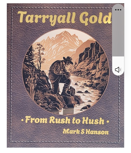
Tarryall Valley: Gold, Glaciers, and Giants – a 160-year history of the miners, mines, cabins, and the resulting patina on today’s Tarryall Valley of Colorado’s Front Range. A resident and owner of several patented gold claims, Mark will discuss the geology, economic resources, exploitation, and reforestation activities associated with Colorado’s first gold stampede.
Flyer for 2025 Colorado Scientific Society Past Presidents’ Dinner
View Zoom recording of Colorado Scientific Society September 2025 Past Presidents’ Dinner and Meeting:
Tarryall Valley: Gold, Glaciers, and Giants, Mark S. Hanson
No passcode is needed to access this recording. Just click on the video.
Duration: 00:56:00
Watching this video is best in full screen. (It may sharpen up images.)
DISCLAIMER and FAIR-USE STATEMENT: The following Zoom-meeting recording contains content that expresses the opinions, viewpoints, and conclusions of the speakers and does not necessarily reflect the views, policies, or endorsements of the Colorado Scientific Society. This recording is made available to the public for general information and educational purposes only and is not intended to be used for profit. Any use of copyrighted material included therein for other purposes must obtain express written permission from the author.
=
CSS October 2005 Meeting
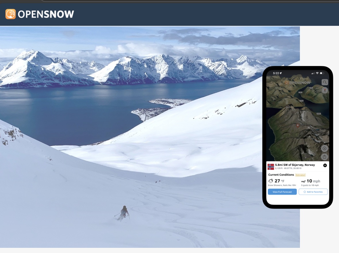
AI Innovations for Weather, Snow, and Avalanche Risk
Thursday, October 16, 2025
Joel Gratz, CEO & Founding Meteorologist of OpenSnow
OpenSnow is a weather forecasting and snow conditions information service.
AI Innovations for Weather, Snow, and Avalanche Risk
Abstract: Artificial intelligence has made it possible for small teams to create new forecast models and communication techniques focused on solving specific problems. Learn about four new AI-based technologies that OpenSnow has created during the past year and that will be live for the upcoming winter season.
Joel Gratz, CEO & Founding Meteorologist of OpenSnow
Joel Gratz is the founding meteorologist and Colorado forecaster for OpenSnow, a mobile app and website that provides snow forecasts, travel advice, and year-round weather data to millions of skiers, snowboarders, and adventurers every year. Joel has a meteorology degree from Penn State, a Master’s and MBA from the University of Colorado, and has been a die-hard skier and weather nerd since elementary school.
View Zoom recording of Colorado Scientific Society October 2025 Meeting:
AI Innovations for Weather, Snow, and Avalanche Risk
No passcode is needed to access this recording. Just click on the video.
Duration: 01:16:29
Watching this video is best in full screen. (It may sharpen up images.)
DISCLAIMER and FAIR-USE STATEMENT: The following Zoom-meeting recording contains content that expresses the opinions, viewpoints, and conclusions of the speakers and does not necessarily reflect the views, policies, or endorsements of the Colorado Scientific Society. This recording is made available to the public for general information and educational purposes only and is not intended to be used for profit. Any use of copyrighted material included therein for other purposes must obtain express written permission from the author.
=
CSS November 2005 Meeting
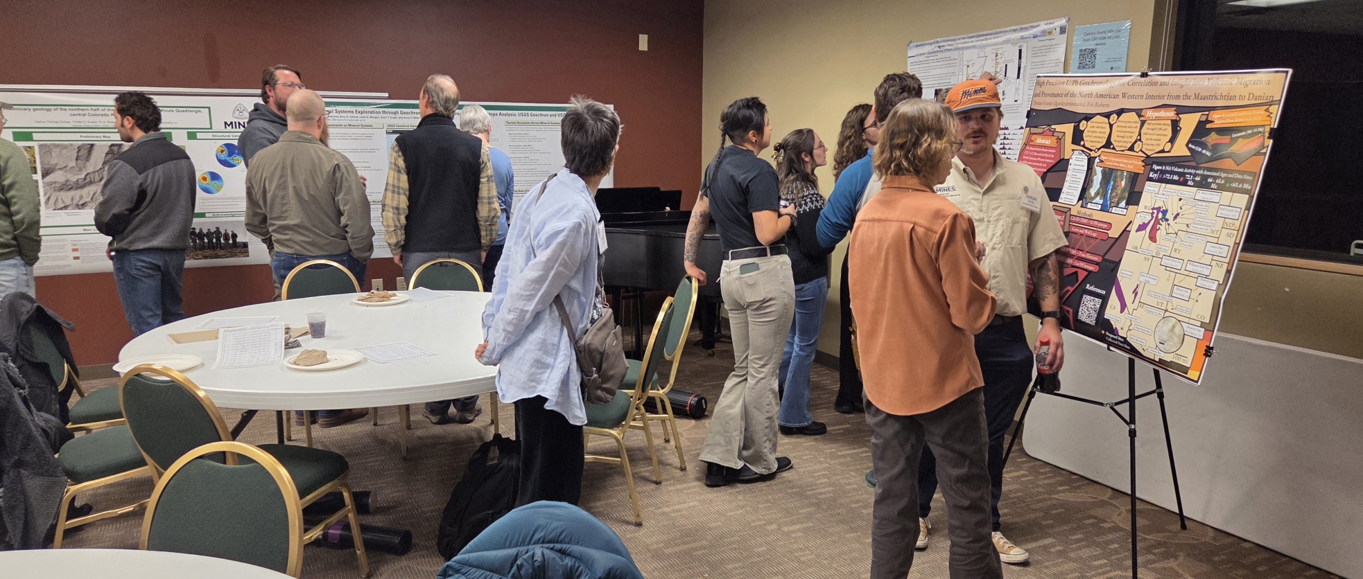
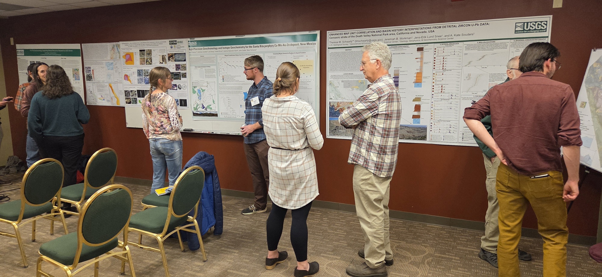
CSS Poster and Lightning Talk Night for Students and Early Career Earth Scientists
Thursday, November 20, 2025
This is a chance for student and early career earth scientists to present their research via a poster and a Lightning Talk (3 minutes) on their research.
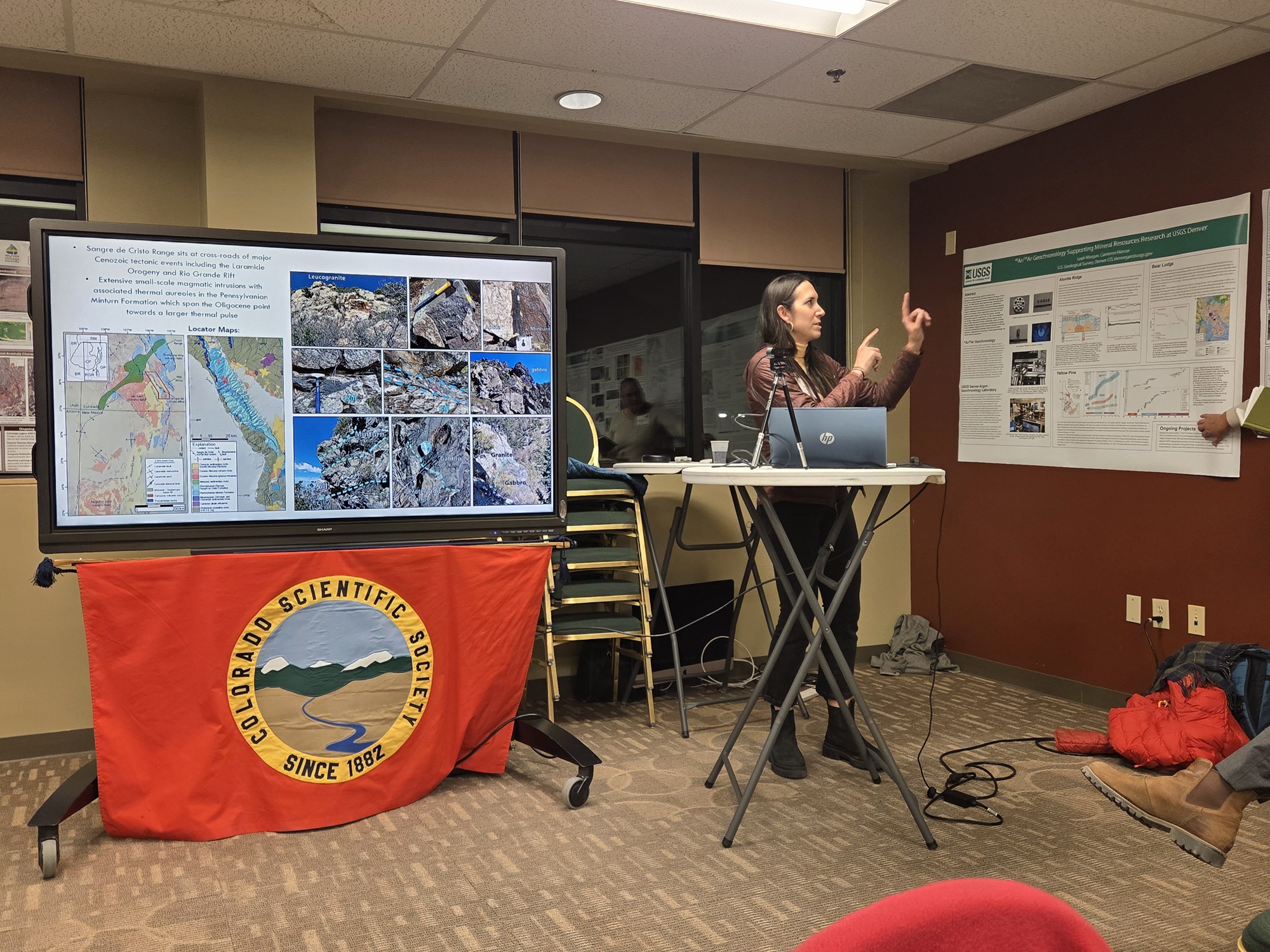
We had pizza with beer and soft drinks for refreshments.
This meeting was held at Calvary Church Golden.
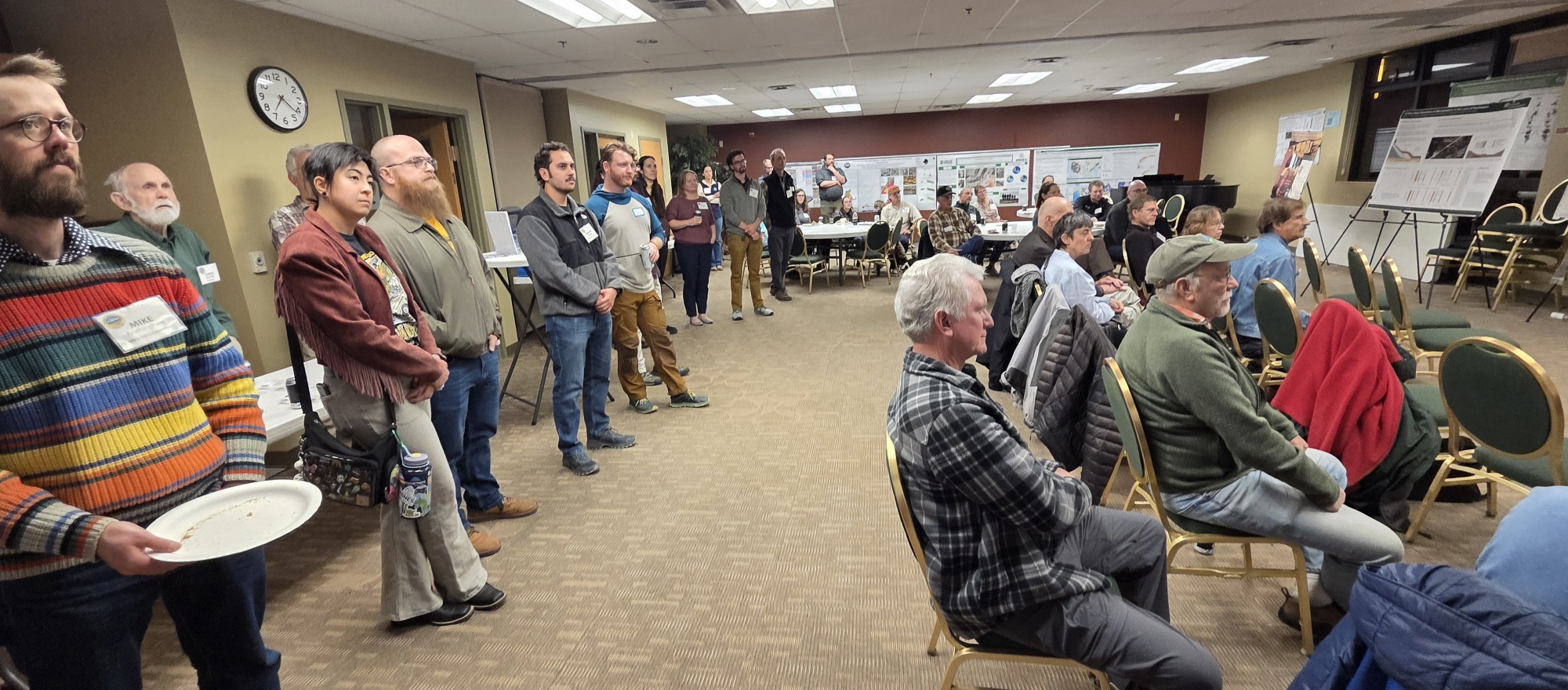
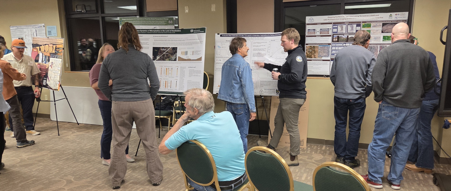
Presentations and Presenters
Thermometric, Geochronologic, and Petrologic Evidence for an Oligocene Thermal Pulse in the Sangre de Cristo Range, Southern Colorado
Samantha Malavarca, Colorado State University
New Detailed Geologic Mapping of the Sand Creek and Little Sand Creek Fault Systems, Sangre De Cristo Mountains, Colorado
Dylan Frawley, Colorado State University
Neogene Southwestern U.S. Temperatures Paced by Global Temperature Change
Rachel Bernstein, Colorado State University
Preliminary geology of the northern half of the Loveland Pass 7.5 minute Quadrangle, central Colorado Front Range
Joshua Thomas, Colorado School of Mines
Subsurface Dynamics of Microplastics in the Land of Headwaters
Ashley Ford, Colorado State University
Deformation along the Nashoba-Avalon terrane boundary in Eastern Massachusetts
Nikhil Arolkar, Department of Geology and Geological Engineering, Colorado School of Mines
Enhancing mineral systems exploration through geochronology, thermochronology, and isotope analysis: USGS Geochron and USGS Isotope databases
Kelly Thomson, Geosciences and Environmental Change Science Center, USGS
Stratigraphic Correlation and High Precision Age Determination of the Middle and Lower Hell Creek Formation
Dorian Gursky, Colorado School of Mines – Geology Department
Sedimentology & Geochronology of the Upper Cretaceous Santa Marta Fm, James Ross Island, Antarctica
Zoë Bowers, Colorado School of Mines
Mapping Surface Deformation using Terrestrial LiDAR and UAS-Multispectral Imaging at the Axial Underground Coal Mine Fire
Jessie Hiatt, Colorado School of Mines
Age and Depositional Framework of an Enigmatic “Shelf-Isolated” Sandstone: The Late Turonian Wall Creek-Turner System, WY
Patrick Sullivan, Colorado School of Mines
High-Precision Geochronology and Isotope Geochemistry for the Santa Rita porphyry Cu-Mo-Au-Zn deposit, New Mexico
Sean Gaynor, USGS
40Ar/39Ar Geochronology Supporting Mineral Resources Research at USGS Denver
Cameron Mercer, U.S. Geological Survey
Enhanced Map Unit Correlation and Basin History interpretations from Detrital Zircon U-Pb data: Cenozoic strata of the Death Valley National Park area, California and Nevada, USA
Theresa Schwartz, US Geological Survey
We did not capture the Posters and Lightning Talks in a video
=
CSS December Potluck, Business Meeting, and 2025 President’s Address
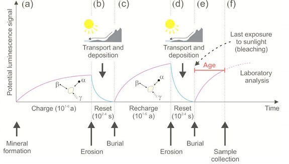
Optically Stimulated Luminescence Dating;
Used for Geochronologic data to reveal late Pleistocene to Holocene debris-flow history and wildfire association within Whiskeytown National Recreation Area, Klamath Mountains, northern California
Tuesday, December 2, 2025
Presentation by: Shannon Mahan, U. S. Geological Survey and Colorado Scientific Society 2025 President
In-person Potluck Dinner at New Terrain Brewing Company for 50 people, or Join us on Zoom
Colorado Scientific Society Annual Business Meeting
2025 Best Paper Award
To Lauren Heerschap from Brunton
View a video of the meeting here: CSS 2025 Archives, April meeting about Brunton
2025 CSS Treasurer’s Report by James Paces
Election of new Colorado Scientific Society Councilors
Councilors:
- 2024-2026 term continues: Nate Rogers
- 2024-2026 term continues: Susan Slomski
- 2025-2027 term continues: Lisa Rukstales
- 2025-2027 term continues: Adam Hudson
- 2026-2028 term, proposed candidate, Amy Crandell
- 2026-2028 term, proposed candidate, Madeline Ferguson
Election of new Colorado Scientific Society President-Elect
Presentation of the Silver Gavel from the outgoing President of the Colorado Scientific Society to the incoming CSS President
Shannon Mahan presents the Silver Gavel to Amy Atwater, our incoming CSS President.
See Silver Gavel for details.
Optically Stimulated Luminescence Dating;
Used for Geochronologic data to reveal late Pleistocene to Holocene debris-flow history and wildfire association within Whiskeytown National Recreation Area, Klamath Mountains, northern California
Authors:
Shannon A. Mahana, John R. “Jack” Woodb, Amy E. Eastc, Eric L. Bilderbackd, Emma T. Krolczyka, Brian A. Rasmussene, Karina S. Zyatitskyf, Leticia Hallasg
a U.S. Geological Survey, Luminescence Geochronology Lab, Denver Federal Center, Denver, CO 80225
b National Park Service, Geologic Resources Division, Denver Federal Center, Denver CO 80225
c U.S. Geological Survey, Pacific Coastal and Marine Science Center, 2885 Mission St., Santa Cruz, CA 95060
d U.S. Geological Survey, Geologic Hazards Science Center, Golden, CO 80401
e National Park Service, Lassen Volcanic National Park, PO Box 100, Mineral, CA 96063
f Conservation Legacy, Scientists in Parks Program, 701 Camino del Rio Suite 101, Durango, CO 81301
g Contractor, U.S. Geological Survey Pacific Coastal and Marine Science Center, 2885 Mission St., Santa Cruz, CA 95060
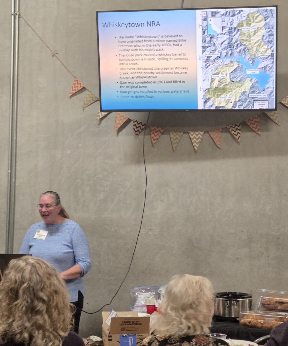
Abstract: Understanding the local to regional history of extreme events such as debris flows and floods provides context to plan for and mitigate these hazards to life, property, and infrastructure. The Klamath Mountains of northwestern California have experienced both debris flows and devastating wildfires. Whiskeytown National Recreation Area (WHIS) is at the heart of this range and has a wealth of debris-flow-related landforms. Gaining an understanding of pre-historic flows and the relationship with fire or other potential triggers can help mitigate future problems.
Optically stimulated luminescence and radiocarbon analyses from sediment and entrained organics in undisturbed facies, including beneath partially buried boulders, establishes a chronology of paleo-events in WHIS. The levee deposits indicate a repetition of debris flows during the latest Holocene, every 125-150 years, since 850 yr. Larger flows occurred, with a record elucidated from debris-flow deposits along Clear Creek, with middle Holocene ages, ca 2600 to 5500 yr, most of which have sufficient concentrations of charcoal to indicate origins as post-fire debris flows. Deposits at higher elevations show events from the latest Pleistocene ca. 13,000 yr. This geochronology indicates that these are not singular events but are relatively common and inherent to the geomorphic processes shaping this landscape.
View Zoom recording of Colorado Scientific Society December 2025 Meeting:
Optically Stimulated Luminescence Dating;
Used for Geochronologic data to reveal late Pleistocene to Holocene debris-flow history and wildfire association within Whiskeytown National Recreation Area, Klamath Mountains, northern California
Note: Shannon did not share her screen with the Zoom meeting during this presentation, so her images are not in the video.
Here are the images from her presentation, so you can see them as she discusses Optically Stimulated Luminescence dating and the Whiskeytown study. This is especially useful for the OSL explanations, and you can examine these images at your own speed.
CSS Dec-2025 Optically Stimulated Luminescence dating, by Shannon Mahan PDF 9.8 MB
No passcode is needed to access this recording. Just click on the video.
Duration: 00:58:01
Watching this video is best in full screen. (It may sharpen up images.)
DISCLAIMER and FAIR-USE STATEMENT: The following Zoom-meeting recording contains content that expresses the opinions, viewpoints, and conclusions of the speakers and does not necessarily reflect the views, policies, or endorsements of the Colorado Scientific Society. This recording is made available to the public for general information and educational purposes only and is not intended to be used for profit. Any use of copyrighted material included therein for other purposes must obtain express written permission from the author.