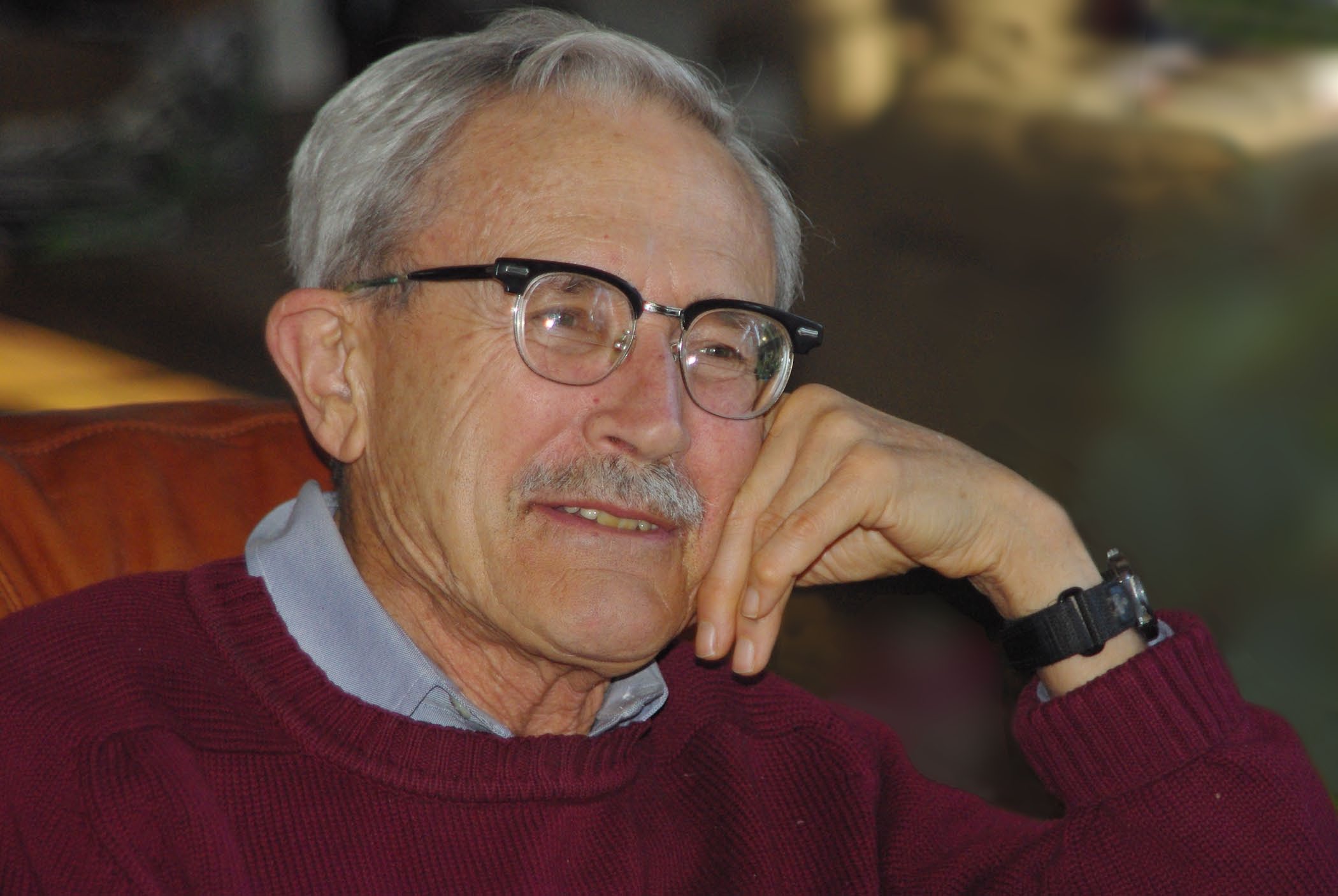
Bruce Bryant
(1930-2021)
President of the Colorado Scientific Society – 1985

- Research geologist with US Geological Survey, where he mapped in North Carolina, Kentucky, Colorado, Utah, and Arizona resulting in over 100 publications
- Graduate: Dartmouth College; University of Washington, Ph.D.
Bryant, Bruce – Obituary
9/25/1930 – 01/12/2021
From the Denver Post, on Jan 17, 2021
Bruce Bryant passed away January 12, 2021, in Boulder, Colorado. He was born in New York City, New York, grew up in Springfield, Vermont attended high school at Hotchkiss in Connecticut, and college at Dartmouth College in New Hampshire. He made his first trip west after graduating from college and fell in love with the west. He attended the University of Washington where he earned his Ph.D. in Geology. He met his wife Dolores Ann Becker (Sandy or San) at Mt Rainier and they settled in Golden, Colorado, and raised their family. Among Bruce’s passions were mountains and the outdoors. He loved fieldwork, skiing, hiking, and instilled that passion for the outdoors in his 4 children. He was active in preserving open spaces and natural resources through the Clear Creek Conservancy and Plan Jeffco in its early days. In addition to the outdoors, he loved knowledge, learning, and travel. He read deeply and broadly and was always quick to bring out reference books at the dinner table. He had a long and productive career as a research geologist with the United States Geological Survey where he mapped in North Carolina, Kentucky, Colorado, Utah, and Arizona resulting in over 100 publications. After retiring he continued to go to the office and write and publish. His family and friends will remember him as a person of great integrity and intellect with a fine sense of humor. Bruce was preceded in death by his wife Sandy (2007) and is survived by his four children Lisa Bryant, Ross Bryant, Keith Bryant, and Mark Bryant, eight grandchildren Will Wells, Reed Bryant, Taylor Bryant, Alexander Bryant, Jesse Bryant, Bianca Bryant, Isabella Bryant, Jeremy Bryant and 4 great-grandchildren Mia Bryant-Lopez, Felipe Bryant-Lopez, Santiago Bryant-Lopez, and Julian Bryant.
Memorial gifts can be made to the Colorado Open Lands 1546 Cole Blvd. #200 Lakewood, CO 80401 https://coloradoopenlands.org/
or the Colorado Scientific Society Memorial Fund P.O. Box 150495 Lakewood, CO 80215-0495 https://coloscisoc.org.

Celebrating the Geological Contributions of Bruce Bryant
by Scott Lundstrom, Colorado Scientific Society (CSS) President in 2014
Bruce Bryant had a hugely productive and significant career, largely in the U.S. Geological Survey (USGS), contributing geologic mapping and research of great breadth and depth topically, geologically, and geographically. From his formative years at home near Springfield, Vermont, Bruce ventured some 50 miles up the Connecticut River valley to Dartmouth College for a bedrock-solid start to his geologic career. In this wintry New England setting, Bruce competed as a Piney (alpine racing events) for the Dartmouth Ski Team, and enjoyed skiing for much of his life, along with periodic ROX department reunions in Hanover and elsewhere. He earned his Ph.D. at the University of Washington ca. 1957 with advisor Peter Misch on aspects of high-grade metamorphosed terrains of the North Cascades – expertise that he expanded throughout his career while mapping basement geology in many parts of the country.
His early work with the U.S. Geological Survey was as a geologic mapper in a group focused on the Bear Paw Mountains of Montana, led by a future Director of the USGS, W.T. Pecora. One of his next major field campaigns was mapping the region of the Grandfather Mountain “window” (exhumed exposures of younger rock beneath thrust sheets of overlying older rocks) of the North Carolina Appalachians, working with colleague Jack Reed (another famous geologist and CSS President, 1994). Bruce and Jack’s work on the structures and map units of this area was the start of years of collaboration between the two, which resulted in a lifelong friendship. They worked together and independently on areas of the Front Range, including the Evergreen Quadrangle. Bruce completed detailed geologic mapping of several quads comprising the Aspen, Colorado region, which includes rugged montane landscapes of the Elk Range. These and other magnificent exposures sampled the wide range of geologic systems of Colorado, requiring Bruce to understand much more than processes affecting the geologic basement. In one paper, Bruce measured and documented the rate of movement of a rock glacier on the flank of the Maroon Bells.
Bruce served as president of the Colorado Scientific Society in 1985 and led several field Trips for CSS and for the Geologic Society of America. For many later years, Bruce was exceptionally generous in his financial contributions to the CSS Memorial funds that support student research projects.
Bruce was the lead compiler for the Denver 1:250,000 geologic map that spanned the Front Range; the integration of new and major older mapping in such regional compilations were the basis for the masterful synthesis of the 1979 State Geologic Map of Colorado (Tweto, 1979) and for later digital 1:100,000 regional maps derived and updated for the same area. Bruce was the lead compiler for the Salt Lake City 1×2-degree quadrangle that included the central Wasatch Range, the Western Uinta Mountains, and his new mapping of the Farmington Canyon Proterozoic complex that forms the oldest core of the Wasatch.
In 1995 during the devastating budgetary Reduction in Force (RIF) affecting the Geologic Division of the USGS, Bruce was able to retain his position, but after an already full career with the USGS, decided to retire in order to free up a position for a younger USGS geologist. This act is but one example of Bruce’s extraordinary generosity. Lisa Fisher (CSS President, 2011) wrote: “Bruce always welcomed me to discuss my Front Range Precambrian thesis and dissertation studies. He was helpful, kind, and supportive, and I truly benefited from his advice and experience. A true gentleman and an insightful scientist, I will miss him.” As an emeritus USGS geologist, Bruce’s service and dedication hardly wavered. He worked on the metamorphic core complex terrain of the lower Colorado River corridor of western Arizona and the Glenwood Canyon area of the upper Colorado River corridor, producing geologic maps of the Alamo Lake region and the Storm King Mountain quadrangle, and associated reports.
During 2015-16, my wife Pam and I visited Bruce at his Mount Vernon home to deliver a cherry pie (for any of Pam’s pies to not be consumed in our home was not my preference, but in this case, I could not protest). Bruce, then 85 and armed with ski poles in each hand for unneeded support, led us on a loop hike on parts of the Beaver Brook and Gudy Gaskell trails, and we could hardly keep up. That was my most vivid recent memory with Bruce which I always will greatly value along with my copies of his published reports.
A selected sampling of publications authored by Bruce Bryant
(in most regions represented here, there are 2 to 4-fold more publications by Bruce)
Bruce Bryant, R.G. Schmidt, W.T Pecora, 1960, Geology of the Maddux quadrangle, Bearpaw Mountains, Blaine County, Montana: U.S. Geological Survey Bulletin 1081-C
Bryant, Bruce, and Reed, J.C., Jr. 1969, Significance of lineation and minor folds near major thrust faults in the southern Appalachian and the British and Norwegian Caledonides, Geological Magazine 106(05): 412 – 429
Bryant, Bruce and Reed, J.C., Jr. 1970, Geology of the Grandfather Mountain Window and vicinity, North Carolina and Tennessee: U.S. Geological Survey Professional Paper 615, 188 p., 7 pls., 106 figs., 30 tables.
Bruce Bryant, 1971, Geologic map of the Aspen quadrangle, Pitkin County, Colorado: U.S. Geological Survey Geologic Quadrangle 933; Bruce also mapped adjoining GQs of Highland Peak, Hayden Peak, and Maroon Bells
Bruce Bryant, 1979, Geology of the Aspen 15-minute quadrangle, Pitkin and Gunnison counties, Colorado: U.S. Geological Survey Professional Paper 1073
Bruce Bryant, Peter L. Martin, 1988, The geologic story of the Aspen region; mines, glaciers, and rocks: U.S. Geological Survey Bulletin 1603
Bruce Bryant, Glenn R. Scott, Robert D. Miller, 1973, Geologic map of the Indian Hills quadrangle, Jefferson County, Colorado: U.S. Geological Survey Geologic Quadrangle 1073
Bruce Bryant, L.W. McGrew, R.A. Wobus, 1981, Geologic map of the Denver 1 x 2 degree quadrangle, north-central Colorado: U.S. Geological Survey Map I-1163
Bruce Bryant, Ogden Tweeto, 1982, Guidebook to Geology of West-Central Colorado (PDF 6.5 MB) Colorado Scientific Society, Fall Field Trip, 1982
(Click on link to download.)
Bruce Bryant, 1988, Geology of the Farmington Canyon Complex, Wasatch Mountains, Utah: U.S. Geological Survey Professional Paper 1476
Bruce Bryant, 1992, Geologic map of the Salt Lake City 1 x 2 degree quadrangle, Utah and Wyoming: U.S. Geological Survey Map I-1997
Bruce Bryant, C. W. Naeser, Joan Fryxell, 1990, Implications of low-temperature cooling history on a transect across the Colorado Plateau-Basin and Range boundary, west-central Arizona, Journal of Geophysical Research 96 (B7): 12375-12388
Bruce Bryant, J.L. Wooden, L. David Nealey, 2001, Geology, geochronology, geochemistry, and Pb-isotopic compositions of Proterozoic rocks, Poachie region, west-central Arizona; a study of the east boundary of Proterozoic Mojave crustal province: U.S. Geological Survey Professional Paper 1639
CSS Meeting and Field Trip Honoring Bruce Bryant
In September, 2010 the Colorado Scientific Society honored Bruce Bryant with “An Evening Honoring Bruce Bryant and His Geologic Research in the Aspen Region” as reported in the September 2010 CSS Newsletter.
This was followed by the Fall 2010 CSS Field Trip to the Aspen region honoring Bruce Bryant, which Bruce participated in. See photos on page 5 of the October 2010 CSS Newsletter or at the 2010-Sept, Grand Loop Field Trip entry.

