2023 Colorado Scientific Society Fall Field Trip
Touring Pikes Dome
Deformation of the Rocky Mountain Erosion Surface and Its Effects on Landscape Evolution and Drainage Reorganization across the Colorado Piedmont and Front Range
September 9-10, 2023
Ned Sterne*, Cal Ruleman**, Bob Raynolds***, and Steve Keller****
*Independent Geologist, ** United States Geological Survey, ***Denver Museum of Nature and Science, ****Colorado Geological Survey
To jump to the Touring Pikes Dome Field Trip Guide below, click here.
The trip started and ended at the Littleton-Downtown RTD Station Park and Ride. We spent the night around the Goldfield and Victor, CO area.
Trip Summary
Since the 1870’s when Archibald R. Marvine, geologist extraordinaire with the Hayden Expedition, recognized the accordant summits of the Front Range were beveled by erosion, geologists have pondered the evolution of what we now call the Rocky Mountain Erosion Surface (RMES). The surface formed between the end of Laramide contraction at ~45Ma and the advent of extension and voluminous volcanism of the Ignimbrite Flareup that blanketed it by ~37 Ma. These events bracket a period of stasis in the trajectory of the subducting Farallon Plate relative to the overriding crust of North America, once the plate reached its easternmost excursion due to flattening of its subduction angle, and started to roll back to the west or founder.
The RMES is a surface of mostly low to moderate relief. What caused the relief and when it developed have long been debated by geologists and will be the focus of our field trip. Luminaries such as Thomas S. Lovering and Francis M. Van Tuyl explained the relief solely by erosion with the oldest of 14 surfaces preserved at high elevations and the youngest at low elevations. In contrast, illustrious pioneers such as Samuel H. Scudder, Arthur Lakes and George H. Stone recognized relief on the RMES was also due to later deformation by studying the ancestral rivers that once flowed across the it. Recent cosmogenic dating by current CSS president, Cal Ruleman, and coworkers of high-level gravels in the Clear Creek drainage thought traditionally to be Miocene indicates they are Pleistocene, which shows the importance of dating these enigmatic deposits.
During this trip we will be traversing Pikes Dome, a post-Laramide uplift that extends some 500 km from west of Pikes Peak into western Kansas. Since its initial rise in the latest Eocene, the dome diverted the southerly flows of the ancestral South Platte and Castle Rock rivers first to the east into the now extinct Hayden-Divide-Arikaree River and finally to the northeast into the current course of the South Platte River. We will also ponder from afar the Arkansas River that flowed south through the Wet Mountain Valley during the middle to upper Eocene and was diverted east during the Oligocene between the rising Pikes Dome on the north and the Raton Dome on the south. Our discussion will be framed by a new structure map of the RMES across Colorado and parts of neighboring states compiled by past CSS president, Ned Sterne, and ongoing cosmogenic, detrital zircon and detrital sanidine dating of the various ancestral river gravels that rest on the RMES. Stops at Daniels Park and the Paint Mines will highlight the Cretaceous to Eocene Laramide synorogenic deposits predating the RMES that have been detailed by Marieke Dechesne, Kirk Johnson and past CSS presidents Peter Barkmann and Bob Raynolds.
Our travels will take us south of Denver to Jackass Hill, Daniels Park, Castle Rock, Castlewood Canyon State Park, the Paint Mines at Calhan, the Florissant Fossil Beds National Monument, Lake George, Tarryall Creek, Divide, the Rampart Range and back to Littleton via Deckers and the South Platte River. Join us as we follow the path forged by a host of CSS past presidents who have grappled with the evolution of our Cenozoic landscape, including Matt Morgan, Vince Matthews, Emmett Evanoff, Jack Reed, Rudi Epis, Wally Hansen, Tom Steven, Glen Izett, Glenn Scott and Ogden Tweto.
Itinerary
Day 1 – Saturday 9/9/23.
Meeting Place: Meet at the Littleton-Downtown RTD Station Park and Ride at 7:30 AM on Saturday 9/9/23.
Stop 1. – Jackass Hill overview (39.580641, -105.018266)
– Trip logistics and introductions
– North-flowing South Platte River
– Rocky Mountain Erosion Surface and Pikes Peak
– Age of high-level gravels in Bear Creek, Clear Creek and Coal Creek drainages
– Age of the 700-meter valleys the gravels reside in?
– Age of the 300-meter incision below the gravels?
Stop 2. – Daniels Park (39.473112, -104.921683) (toilet)
– Rocky Mountain Erosion Surface and Pikes Peak
– Denver Basin Project
– Pre-RMES D1 & D2 synorogenic patterns
Stop 3. – Castle Rock (39.381653, -104.857757) (toilet)
– Rocky Mountain Erosion Surface and Pikes Peak
– Castle Rock Conglomerate
Stop 4. – Castlewood Canyon State Park (39.329797, -104.738258) (toilet)
– Castle Rock River vs. Cherry Creek
– Lunch
Stop 5. – Paint Mines Interpretive Park, Calhan (39.020488, -104.274258) (toilet)
– Southern preservation limit of the Castle Rock Conglomerate
– Pre-RMES D1 Sequence, paleosol, and D2 Sequence
– Pikes Dome axis at the South Platte-Arkansas drainage divide
– Ancestral Castle Rock River drainage reversal
– Sand Creek valley – ancestral Hayden-Divide-Arikaree River course
– Canon City lahar outcrops – Arkansas River in RMES low.
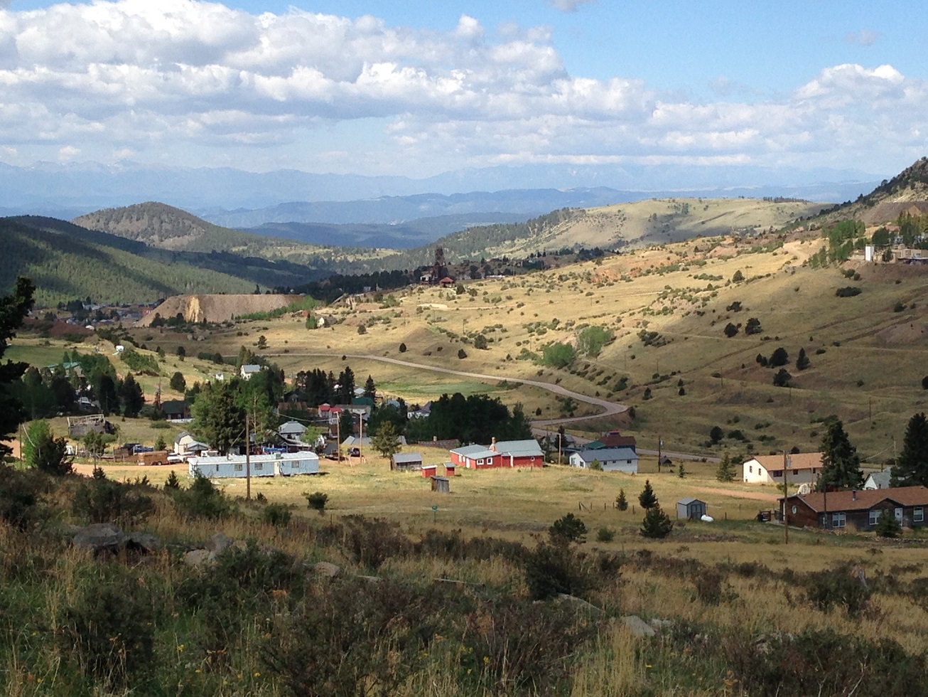
Stop 6. – Potluck dinner at Sterne’s red cabin – Ninth Street and Independence Ave., Goldfield
(38.719981, -105.124512)
Day 2 – Sunday 9/10/23.
Stop 7. Meeting time and place: Meet at 8:00 AM at the Lowell Thomas Museum, 298 Victor Ave., Victor, CO 80860,
Stop 8. Teller County Rd 112 (38.773904, -105.297695)
– Tallahassee Creek Conglomerate
– Tributaries of the ancestral South Platte River
Stop 9. Evergreen Station (38.821846, -105.259688) (toilet)
– Lake Florissant Lahar dam
– Water wells show buried 500’ canyon below the Florissant Valley
Stop 10. Teller County Rd 1 (38.884808, -105.272848)
– Pikes Dome axis, South Platte-Arkansas drainage divide
Stop 11. Barksdale Picnic Area (38.911911, -105.255959)
– Wall Mountain Tuff
Stop 12. Florissant Fossil Beds National Monument (38.913556, -105.285388) (toilet)
– Samuel Scudder and Arthur Lakes – Lakes’ Florissant Lake map
– Stratigraphy and deformation of the Florissant Valley
– Lunch
Stop 13. Tarryall Road (39.069699, -105.408660)
– Tarryall Creek diversion due to deformation of its original course
– South Platte River now occupies part of the reversed Tarryall Creek drainage
– Stream capture and/or structural deformation?
Stop 14. RT 24 and Twin Rocks Rd. (38.934680, -105.186490)
– George H. Stone’s Extinct Hayden River – Divide Gravels
Stop 15. Woodland Park Rest Area (38.994051, -105.054477) (toilet)
– rest stop
Stop 16. Rampart Range Road (38.982708, -105.016377)
– Hayden River – Divide Gravels
– Ute Pass Fault offset of the Hayden-Divide-Arikaree River
– Pikes Peak: structural uplift or erosional monadnock?
End of Trip: Littleton-Downtown RTD Station Park and Ride (5777 South Prince St., Littleton)
– 7:00 pm
=
CSS Touring Pikes Dome Field Trip Guide
Download the field trip guide here:
Touring Pikes Dome – Deformation of the Rocky Mountain Erosion Surface and Its Effects on Landscape Evolution and Drainage Reorganization across the Colorado Piedmont and Front Range, 13.4 MB, 60 pages
This is the Nov. 12, 2025 update.
September 9-10, 2023
Co-Leader and field guide author: Ned Sterne (Independent)
Co- Leaders: Cal Ruleman (US Geological Survey), Bob Raynolds (Denver Museum of Nature and Science), and Steve Keller (Colorado Geological Survey)