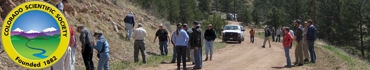
2024 Colorado Scientific Society Field Trip
Fountain Formation in Red Rocks Park
March 30, 2024 9:00 am – 12:00 noon
Steve Cumella, Consulting geologist; Mark Kirschbaum, USGS: and John Webb led this trip.
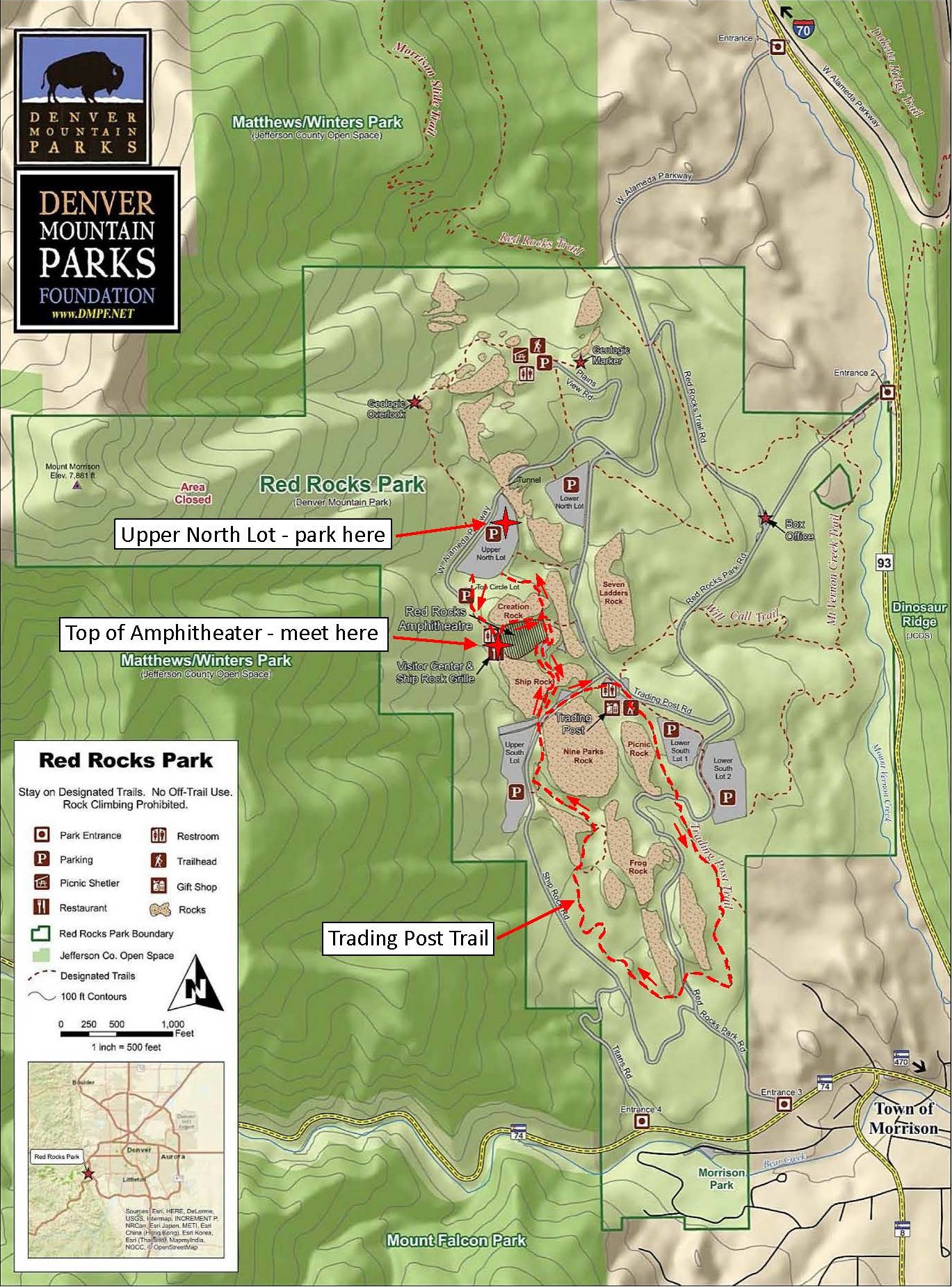
Join Steve Cumella and Mark Kirschbaum on Saturday March 30th for a 3-hour tour of the spectacular Fountain outcrops in Red Rocks Park near Morrison, Colorado. Park in the Upper North Lot (see attached map) and meet at 9:00 AM at the top of the Amphitheater. From there, we will walk 2.25 miles through the Amphitheater and along the Trading Post Trail for a cumulative 675’ of elevation gain and 670’ of elevation loss. Park entry is free and all are welcome to join us for this Colorado Scientific Society No Moss Gathering. Bring your expertise, your questions, your curiosity, and most of all – have fun!

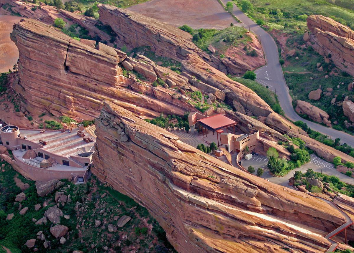
The Pennsylvanian-age Fountain Formation is spectacularly exposed at the Red Rocks Amphitheater near Morrison, Colorado. The Fountain is composed of thick-bedded arkosic sandstones and conglomerates interbedded with dark maroon mudstones. The Fountain is believed to have been deposited by alluvial fans being shed eastward from the Ancestral Front Range. On this fieldtrip we will examine sedimentary features of the Fountain. Surprisingly, no detailed modern sedimentologic study has ever been done on the Fountain at Red Rocks, so we can discuss how well the features we observe fit within an alluvial fan model. Fortunately, high-resolution Google Earth imagery is available for the Red Rocks area and this imagery offers the opportunity to attempt to correlate the Fountain stratigraphy. The attached Google Earth images show possible Fountain correlations. (See the “Red Rocks, Google Earth Dec 2020, Cumella” PDF below. The colored lines on the images show possible correlations.) During the fieldtrip we can see how well these correlations hold up.
Flyer for Red Rocks Park No Moss Gathering 3-30-24.
See the Fountain Formation illustrations and background information (3.9 MB).
Images showing correlations: Red Rocks, Google Earth Dec 2020, Cumella, 5.4 MB
Images from the field trip.
Lewis Kleinhans took many photos along the field trip. When you click on the link to Lew’s .kmz file, it will download (22.6 MB). Then, click on the downloaded .kmz file, and it will open in Google Earth with all the photos Lew took.
Red Rocks CSS NMFT 3-30-24.kmz (22.6 MB)
After Google Earth opens, click on the Placemarks along our route to see the pictures.